
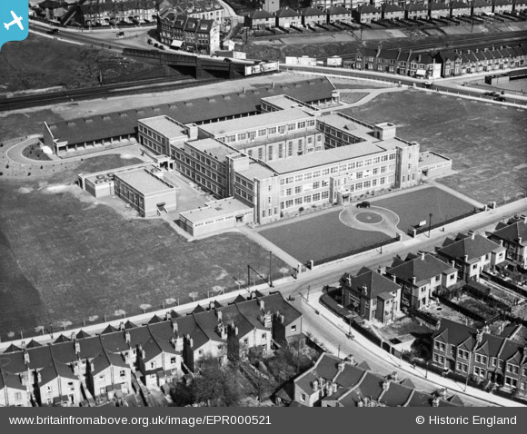
EPR000521 ENGLAND (1935). The Willesden College of Technology on Denzil Road, Willesden, 1935
© Copyright OpenStreetMap contributors and licensed by the OpenStreetMap Foundation. 2026. Cartography is licensed as CC BY-SA.
Nearby Images (2)
EPR000521

EPW006175

Details
| Title | [EPR000521] The Willesden College of Technology on Denzil Road, Willesden, 1935 |
| Reference | EPR000521 |
| Date | 27-March-1935 |
| Link | |
| Place name | WILLESDEN |
| Parish | |
| District | |
| Country | ENGLAND |
| Easting / Northing | 521820, 185077 |
| Longitude / Latitude | -0.24280065272432, 51.550936069995 |
| National Grid Reference | TQ218851 |
Pins
Be the first to add a comment to this image!