
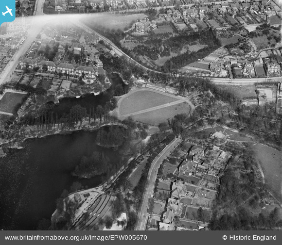
EPW005670 ENGLAND (1921). Walsall Arboretum, Walsall, 1921
© Copyright OpenStreetMap contributors and licensed by the OpenStreetMap Foundation. 2026. Cartography is licensed as CC BY-SA.
Nearby Images (6)
EPW005670

EPW015029

EPW015023

EPW015026

EPW005778

EPW024712

Details
| Title | [EPW005670] Walsall Arboretum, Walsall, 1921 |
| Reference | EPW005670 |
| Date | March-1921 |
| Link | |
| Place name | WALSALL |
| Parish | |
| District | |
| Country | ENGLAND |
| Easting / Northing | 402076, 299181 |
| Longitude / Latitude | -1.9693523880961, 52.590069828747 |
| National Grid Reference | SP021992 |
Pins

Class31 |
Wednesday 31st of October 2012 05:25:18 PM | |
|
Class31 |
Wednesday 31st of October 2012 05:24:13 PM | |
|
Class31 |
Wednesday 31st of October 2012 05:23:35 PM | |
|
Class31 |
Wednesday 31st of October 2012 05:22:55 PM | |
|
Class31 |
Wednesday 31st of October 2012 05:22:15 PM | |
|
Class31 |
Wednesday 31st of October 2012 05:21:35 PM | |
|
Class31 |
Wednesday 31st of October 2012 05:20:51 PM |