
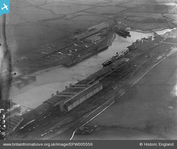
EPW005556 ENGLAND (1921). Portishead Dock, Portishead, 1921
© Copyright OpenStreetMap contributors and licensed by the OpenStreetMap Foundation. 2026. Cartography is licensed as CC BY-SA.
Nearby Images (7)
EPW005556

EAW002076

EAW021199

EAW002075

EPW005566

EAW021198

EPW005557

Details
| Title | [EPW005556] Portishead Dock, Portishead, 1921 |
| Reference | EPW005556 |
| Date | 20-March-1921 |
| Link | |
| Place name | PORTISHEAD |
| Parish | PORTISHEAD AND NORTH WESTON |
| District | |
| Country | ENGLAND |
| Easting / Northing | 347292, 176979 |
| Longitude / Latitude | -2.7592339068664, 51.488815288433 |
| National Grid Reference | ST473770 |
Pins

Class31 |
Sunday 3rd of February 2013 10:53:46 PM |
User Comment Contributions

Portishead station and docks. |

JohnB |
Thursday 5th of July 2012 12:01:42 PM |