
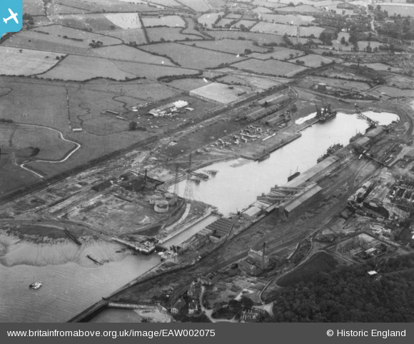
EAW002075 ENGLAND (1946). Portishead Dock, Portishead, 1946. This image has been produced from a print.
© Copyright OpenStreetMap contributors and licensed by the OpenStreetMap Foundation. 2026. Cartography is licensed as CC BY-SA.
Nearby Images (7)
EAW002075

EAW021199

EPW005557

EPW005556

EPW008654

EAW002076

EAW021198

Details
| Title | [EAW002075] Portishead Dock, Portishead, 1946. This image has been produced from a print. |
| Reference | EAW002075 |
| Date | 31-July-1946 |
| Link | |
| Place name | PORTISHEAD |
| Parish | PORTISHEAD AND NORTH WESTON |
| District | |
| Country | ENGLAND |
| Easting / Northing | 347463, 177017 |
| Longitude / Latitude | -2.7567766209468, 51.489172892563 |
| National Grid Reference | ST475770 |
Pins

gerry-r |
Saturday 10th of August 2024 02:27:29 PM | |

Matt Aldred edob.mattaldred.com |
Monday 21st of March 2022 12:50:08 PM | |
|
redmist |
Saturday 7th of November 2020 08:26:05 PM | |
|
redmist |
Saturday 7th of November 2020 08:25:11 PM | |
|
redmist |
Saturday 7th of November 2020 08:19:43 PM | |
|
redmist |
Saturday 7th of November 2020 08:17:22 PM | |
|
Matt Aldred edob.mattaldred.com |
Thursday 27th of August 2020 08:20:25 PM | |
|
cptpies |
Thursday 11th of January 2018 11:32:15 AM | |
|
cptpies |
Thursday 11th of January 2018 11:30:03 AM | |

Sparky |
Wednesday 13th of September 2017 07:24:11 PM | |
|
Sparky |
Wednesday 13th of September 2017 07:23:49 PM |