
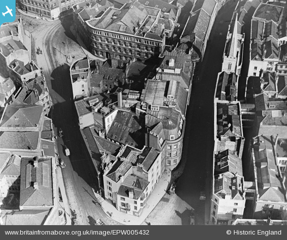
EPW005432 ENGLAND (1921). Quay Street and environs, Bristol, 1921
© Copyright OpenStreetMap contributors and licensed by the OpenStreetMap Foundation. 2026. Cartography is licensed as CC BY-SA.
Nearby Images (16)
EPW005432

EPW005429

EPW005430

EPW005431

EPW022277

EPW005428

EPW060118

EPW047090

EPW005419

EAW050555

EPW005427

EPW005423

EPW005426

EPW047089

EPW005425

EPW033500

Details
| Title | [EPW005432] Quay Street and environs, Bristol, 1921 |
| Reference | EPW005432 |
| Date | 20-March-1921 |
| Link | |
| Place name | BRISTOL |
| Parish | |
| District | |
| Country | ENGLAND |
| Easting / Northing | 358700, 173143 |
| Longitude / Latitude | -2.5944693856591, 51.455270313439 |
| National Grid Reference | ST587731 |
