
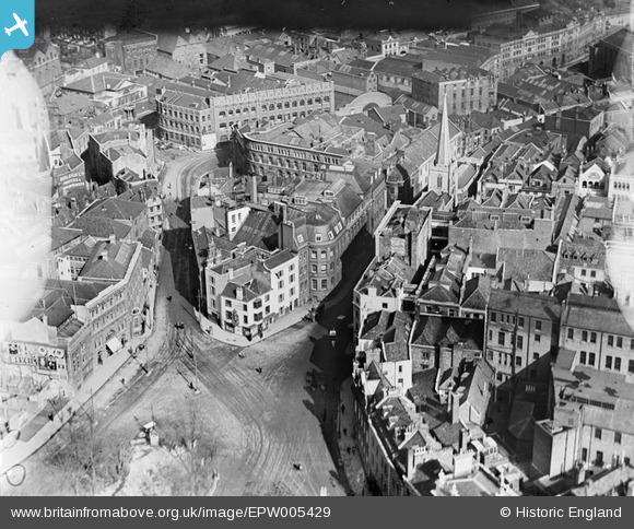
EPW005429 ENGLAND (1921). Quay Street and environs, Bristol, 1921
© Copyright OpenStreetMap contributors and licensed by the OpenStreetMap Foundation. 2026. Cartography is licensed as CC BY-SA.
Nearby Images (18)
EPW005429

EPW005432

EPW005430

EPW005431

EPW022277

EPW060118

EPW005428

EPW047090

EAW050555

EPW005419

EPW005427

EPW005423

EPW047089

EPW005426

EPW005425

EPW005424

EPR000072

EPW033500

Details
| Title | [EPW005429] Quay Street and environs, Bristol, 1921 |
| Reference | EPW005429 |
| Date | 20-March-1921 |
| Link | |
| Place name | BRISTOL |
| Parish | |
| District | |
| Country | ENGLAND |
| Easting / Northing | 358707, 173129 |
| Longitude / Latitude | -2.5943669990167, 51.45514493492 |
| National Grid Reference | ST587731 |
Pins

hilary |
Tuesday 29th of December 2015 02:06:05 PM | |
|
Braikenridge |
Monday 27th of April 2015 12:58:50 PM | |
|
Braikenridge |
Monday 27th of April 2015 12:55:34 PM | |
|
Braikenridge |
Monday 27th of April 2015 12:53:55 PM | |
|
adfbristol |
Wednesday 26th of June 2013 01:27:14 PM | |
 |

Class31 |
Friday 21st of June 2013 07:26:22 AM |
|
Class31 |
Monday 10th of June 2013 12:46:13 PM | |
|
Class31 |
Wednesday 10th of October 2012 09:31:28 PM | |
|
Class31 |
Monday 8th of October 2012 01:20:36 PM | |
|
MB |
Friday 7th of September 2012 10:43:29 PM | |
|
MB |
Friday 7th of September 2012 10:36:23 PM | |
|
MB |
Friday 7th of September 2012 10:33:38 PM | |
|
Alan Marshall |
Wednesday 27th of June 2012 11:21:47 AM | |
It's not Corn Street! See http://www.researchpress.co.uk/gunmakers/england/gibbs/index.htm - it's Rupert Hall, St John's Bridge |
SteveRH |
Sunday 21st of October 2012 08:23:25 PM |
Corn Street runs to the right of the photograph, from the corner of Baldwin Street, up to Wine Street and High Street. St John's on the Wall also had Broad Street running from it up to Corn Street. |
hilary |
Tuesday 29th of December 2015 02:08:52 PM |
|
Alan Marshall |
Wednesday 27th of June 2012 11:14:01 AM | |
|
Alan Marshall |
Wednesday 27th of June 2012 09:12:49 AM | |
|
Alan Marshall |
Tuesday 26th of June 2012 02:38:25 PM | |
|
Alan Marshall |
Tuesday 26th of June 2012 02:37:20 PM |

