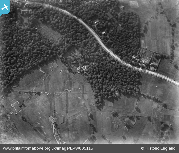
EPW005115 ENGLAND (1920). The Bishops Avenue and Highgate Golf Club, Hampstead, 1920
© Copyright OpenStreetMap contributors and licensed by the OpenStreetMap Foundation. 2026. Cartography is licensed as CC BY-SA.
Nearby Images (8)
Details
| Title | [EPW005115] The Bishops Avenue and Highgate Golf Club, Hampstead, 1920 |
| Reference | EPW005115 |
| Date | 18-October-1920 |
| Link | |
| Place name | HAMPSTEAD GARDEN SUBURB |
| Parish | |
| District | |
| Country | ENGLAND |
| Easting / Northing | 527050, 188204 |
| Longitude / Latitude | -0.166270398726, 51.577887279872 |
| National Grid Reference | TQ271882 |
Pins

Class31 |
Saturday 25th of August 2012 08:35:44 PM |


![[EPW005115] The Bishops Avenue and Highgate Golf Club, Hampstead, 1920](http://britainfromabove.org.uk/sites/all/libraries/aerofilms-images/public/100x100/EPW/005/EPW005115.jpg)
![[EPW056793] White Lodge and other houses along Bishop's Avenue, Hampstead Garden Suburb, 1938](http://britainfromabove.org.uk/sites/all/libraries/aerofilms-images/public/100x100/EPW/056/EPW056793.jpg)
![[EPW056796] White Lodge and other houses along Bishop's Avenue, Hampstead Garden Suburb, 1938](http://britainfromabove.org.uk/sites/all/libraries/aerofilms-images/public/100x100/EPW/056/EPW056796.jpg)
![[EPW056794] White Lodge and other houses along Bishop's Avenue, Hampstead Garden Suburb, 1938](http://britainfromabove.org.uk/sites/all/libraries/aerofilms-images/public/100x100/EPW/056/EPW056794.jpg)
![[EPW056795] White Lodge and other houses along Bishop's Avenue, Hampstead Garden Suburb, 1938](http://britainfromabove.org.uk/sites/all/libraries/aerofilms-images/public/100x100/EPW/056/EPW056795.jpg)
![[EAW046476] Highgate Golf Course, East Finchley and environs, Highgate, from the south, 1952](http://britainfromabove.org.uk/sites/all/libraries/aerofilms-images/public/100x100/EAW/046/EAW046476.jpg)
![[EAW014552] The residential area surrounding Winnington Road and Highgate Golf Club, Hampstead Garden Suburb, 1948](http://britainfromabove.org.uk/sites/all/libraries/aerofilms-images/public/100x100/EAW/014/EAW014552.jpg)
![[EPW005116] Highgate Golf Club, Highgate, 1920](http://britainfromabove.org.uk/sites/all/libraries/aerofilms-images/public/100x100/EPW/005/EPW005116.jpg)