
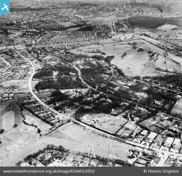
EAW014552 ENGLAND (1948). The residential area surrounding Winnington Road and Highgate Golf Club, Hampstead Garden Suburb, 1948
© Copyright OpenStreetMap contributors and licensed by the OpenStreetMap Foundation. 2026. Cartography is licensed as CC BY-SA.
Nearby Images (8)
EAW014552

EPW056795

EPW005114

EPW056794

EPW056793

EPW056796

EPW005115

EAW014550

Details
| Title | [EAW014552] The residential area surrounding Winnington Road and Highgate Golf Club, Hampstead Garden Suburb, 1948 |
| Reference | EAW014552 |
| Date | 15-April-1948 |
| Link | |
| Place name | HAMPSTEAD GARDEN SUBURB |
| Parish | |
| District | |
| Country | ENGLAND |
| Easting / Northing | 526851, 188073 |
| Longitude / Latitude | -0.16918833560035, 51.576754706036 |
| National Grid Reference | TQ269881 |
