
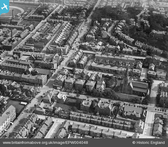
EPW004048 ENGLAND (1920). St James's Church, Rowson Street and environs, New Brighton, 1920
© Copyright OpenStreetMap contributors and licensed by the OpenStreetMap Foundation. 2026. Cartography is licensed as CC BY-SA.
Nearby Images (5)
EPW004048

EPW050655

EPW004050

EAW001713

EPW004049

Details
| Title | [EPW004048] St James's Church, Rowson Street and environs, New Brighton, 1920 |
| Reference | EPW004048 |
| Date | August-1920 |
| Link | |
| Place name | NEW BRIGHTON |
| Parish | |
| District | |
| Country | ENGLAND |
| Easting / Northing | 330749, 393868 |
| Longitude / Latitude | -3.0425648784034, 53.436778857075 |
| National Grid Reference | SJ307939 |
Pins

Mercury |
Saturday 8th of August 2020 10:05:31 AM | |
|
Mercury |
Saturday 8th of August 2020 10:04:46 AM | |
|
Mercury |
Saturday 8th of August 2020 10:04:20 AM | |
|
Pete65 |
Friday 31st of May 2013 06:48:56 PM | |
|
Stuart |
Wednesday 8th of August 2012 09:31:37 PM | |
|
Stuart |
Wednesday 8th of August 2012 09:27:40 PM |