
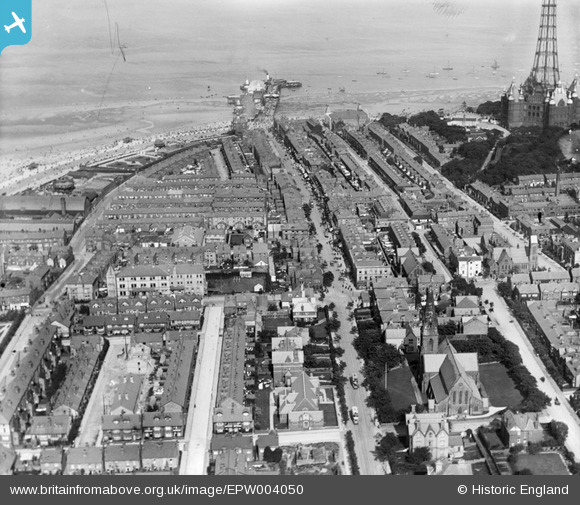
EPW004050 ENGLAND (1920). Victoria Road and environs, New Brighton, 1920
© Copyright OpenStreetMap contributors and licensed by the OpenStreetMap Foundation. 2026. Cartography is licensed as CC BY-SA.
Nearby Images (6)
EPW004050

EPW004048

EAW001713

EPW050655

EPW004056

EPW045205

Details
| Title | [EPW004050] Victoria Road and environs, New Brighton, 1920 |
| Reference | EPW004050 |
| Date | August-1920 |
| Link | |
| Place name | NEW BRIGHTON |
| Parish | |
| District | |
| Country | ENGLAND |
| Easting / Northing | 330844, 394008 |
| Longitude / Latitude | -3.0411656858181, 53.438049659195 |
| National Grid Reference | SJ308940 |
Pins
Be the first to add a comment to this image!
User Comment Contributions
For more information about Victoria Road, please visit http://www.historyofwallasey.co.uk/ |

PaulWirral |
Tuesday 13th of November 2012 06:08:47 PM |