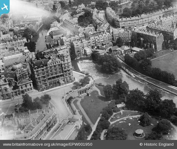
EPW001950 ENGLAND (1920). The Weir and Parade Gardens, Bath, 1920
    © Copyright OpenStreetMap contributors and licensed by the OpenStreetMap Foundation. 2025. Cartography is licensed as CC BY-SA.
  
Nearby Images (38)
Details
| Title | [EPW001950] The Weir and Parade Gardens, Bath, 1920 | 
| Reference | EPW001950 | 
| Date | July-1920 | 
| Link | |
| Place name | BATH | 
| Parish | |
| District | |
| Country | ENGLAND | 
| Easting / Northing | 375241, 164874 | 
| Longitude / Latitude | -2.3558081536962, 51.381877022446 | 
| National Grid Reference | ST752649 | 
Pins
|  Henrietta Park |   Mitch | Saturday 27th of October 2012 09:27:42 PM | 
|  Spring Gardens |   Mitch | Saturday 27th of October 2012 09:26:19 PM | 
|  The Market |   Mitch | Saturday 27th of October 2012 09:25:20 PM | 
|  Institution Gardens (1902 Ord Survey) |   Mitch | Saturday 27th of October 2012 07:59:44 PM | 
|  Bath Royal Institution |   Mitch | Saturday 27th of October 2012 07:56:54 PM | 
|  Orange Grove |   Mitch | Saturday 27th of October 2012 07:54:20 PM | 
|  Laura Place |   Mitch | Saturday 27th of October 2012 07:50:28 PM | 
|  The Rec. (Bath Rugby Club) |   Mitch | Saturday 27th of October 2012 07:47:59 PM | 
|  The weir was remodelled after the 1968 floods |   MB | Wednesday 19th of September 2012 07:54:15 AM | 
|  Bathwick Mill |   MB | Wednesday 19th of September 2012 07:52:51 AM | 
|  Guildhall |   Jeffrey | Wednesday 29th of August 2012 06:40:29 PM | 
|  Pulteney Bridge |   Jeffrey | Wednesday 29th of August 2012 06:38:58 PM | 
|  Grand Parade |   kent | Saturday 28th of July 2012 09:37:21 AM | 
|  Grove Street |   kent | Saturday 28th of July 2012 09:35:42 AM | 
|  Great Pulteney Street |   kent | Saturday 28th of July 2012 09:33:57 AM | 
|  Argyle Street |   kent | Saturday 28th of July 2012 09:31:11 AM | 
|  Johnstone Street | Class31 | Tuesday 10th of July 2012 10:12:38 AM | 
|  Argyle Street | Class31 | Tuesday 10th of July 2012 10:12:07 AM | 
|  Henrietta Street | Class31 | Tuesday 10th of July 2012 10:10:56 AM | 
|  The Empire Hotel |   Ormerod | Thursday 28th of June 2012 07:35:32 PM | 
User Comment Contributions
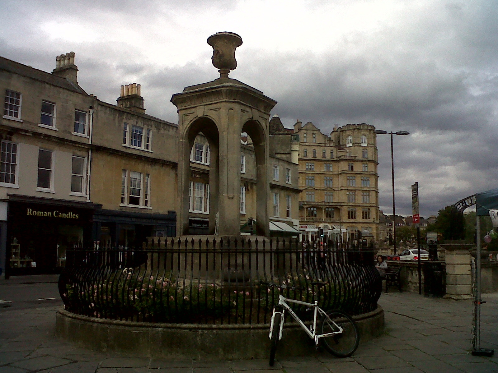
|   Terrace Walk and the Empire Hotel 07/09/2013 17.06hrs | Class31 | Monday 6th of January 2014 01:30:11 PM | 
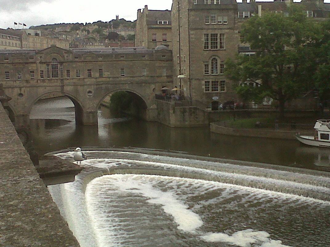
|   Pulteney Bridge from Grand Parade looking north. | Class31 | Wednesday 31st of July 2013 09:57:16 PM | 
| ‘Bathwick Mill. Grove Street.. sale by auction .. instructions from Messrs Emerson and Parks, millers, who are dissolving partnership .. stock-in-trade .. about 250 sacks of best seconds flour .. six sacks superfine flour, ..five sacks thirds flour, six tons fine sharps, ..ton of bran, half ton barley meal .. A very superior and powerful Gray Cart Horse (Blossom).. rising 5 years old, staunch and a good worker ..’ Bristol Mercury 28 December 1867. |   MB | Thursday 11th of October 2012 11:45:36 AM | 
| Thank you MB for the additional info here. Great Stuff. | Paul Marks | Thursday 11th of October 2012 11:45:36 AM | 
 
             
  ![[EPW001950] The Weir and Parade Gardens, Bath, 1920](http://britainfromabove.org.uk/sites/all/libraries/aerofilms-images/public/100x100/EPW/001/EPW001950.jpg) 
  
                                          ![[EPW048402] Bath and County Recreation Ground, the Cricket Ground and environs, Bath, 1935](http://britainfromabove.org.uk/sites/all/libraries/aerofilms-images/public/100x100/EPW/048/EPW048402.jpg) 
 ![[EPW001957] General view of the town centre, Bath, from the east, 1920](http://britainfromabove.org.uk/sites/all/libraries/aerofilms-images/public/100x100/EPW/001/EPW001957.jpg) 
 ![[EAW049901] Bath, the second day of the Somerset-Kent county cricket match, 1953](http://britainfromabove.org.uk/sites/all/libraries/aerofilms-images/public/100x100/EAW/049/EAW049901.jpg) 
 ![[EAW000759] The Abbey Church of St Peter and St Paul and the surrounding city, Bath, from the north-east, 1946](http://britainfromabove.org.uk/sites/all/libraries/aerofilms-images/public/100x100/EAW/000/EAW000759.jpg) 
 ![[EAW023885] Parade Gardens and the city centre, Bath, 1949. This image has been produced from a print.](http://britainfromabove.org.uk/sites/all/libraries/aerofilms-images/public/100x100/EAW/023/EAW023885.jpg) 
 ![[EPW001945] The Abbey Church of St Peter and St Paul, Bath, 1920](http://britainfromabove.org.uk/sites/all/libraries/aerofilms-images/public/100x100/EPW/001/EPW001945.jpg) 
 ![[EPW001161] View over Bath city centre and the Abbey, Bath, 1920](http://britainfromabove.org.uk/sites/all/libraries/aerofilms-images/public/100x100/EPW/001/EPW001161.jpg) 
 ![[EAW000754] The city, Bath, from the east, 1946](http://britainfromabove.org.uk/sites/all/libraries/aerofilms-images/public/100x100/EAW/000/EAW000754.jpg) 
 ![[EPW053141] The Abbey Church of St Peter and St Paul, the Roman Baths and the city centre, Bath, 1937](http://britainfromabove.org.uk/sites/all/libraries/aerofilms-images/public/100x100/EPW/053/EPW053141.jpg) 
 ![[EAW023882] The Abbey Church of St Peter and St Paul and the city centre, Bath, from the south-east, 1949. This image has been produced from a print.](http://britainfromabove.org.uk/sites/all/libraries/aerofilms-images/public/100x100/EAW/023/EAW023882.jpg) 
 ![[EPW048403] Bath and County Recreation Ground, the Cricket Ground and environs, Bath, 1935](http://britainfromabove.org.uk/sites/all/libraries/aerofilms-images/public/100x100/EPW/048/EPW048403.jpg) 
 ![[EAW000746] The Abbey Church of St Peter and St Paul and environs, Bath, 1946](http://britainfromabove.org.uk/sites/all/libraries/aerofilms-images/public/100x100/EAW/000/EAW000746.jpg) 
 ![[EAW023884] North Parade Bridge and the city centre, Bath, 1949. This image has been produced from a print.](http://britainfromabove.org.uk/sites/all/libraries/aerofilms-images/public/100x100/EAW/023/EAW023884.jpg) 
 ![[EAW000755] The Church of St John the Evangelist, Abbey Church of St Peter and St Paul and surrounding city, Bath, 1946](http://britainfromabove.org.uk/sites/all/libraries/aerofilms-images/public/100x100/EAW/000/EAW000755.jpg) 
 ![[EAW000761] The city, Bath, 1946](http://britainfromabove.org.uk/sites/all/libraries/aerofilms-images/public/100x100/EAW/000/EAW000761.jpg) 
 ![[EPW001958] General view of the town centre, Bath, from the north, 1920](http://britainfromabove.org.uk/sites/all/libraries/aerofilms-images/public/100x100/EPW/001/EPW001958.jpg) 
 ![[EPW001942] The Abbey Church of St Peter and St Paul and town centre, Bath, 1920](http://britainfromabove.org.uk/sites/all/libraries/aerofilms-images/public/100x100/EPW/001/EPW001942.jpg) 
 ![[EAW000756] The Church of St John the Evangelist, Abbey Church of St Peter and St Paul and surrounding city, Bath, 1946](http://britainfromabove.org.uk/sites/all/libraries/aerofilms-images/public/100x100/EAW/000/EAW000756.jpg) 
 ![[EAW000752] Laura Place, Henrietta Park and Great Pulteney Street, Bath, from the south-west, 1946](http://britainfromabove.org.uk/sites/all/libraries/aerofilms-images/public/100x100/EAW/000/EAW000752.jpg) 
 ![[EAW000748] The Church of St James, Abbey Church of St Peter and St Paul and the surrounding city, Bath, 1946](http://britainfromabove.org.uk/sites/all/libraries/aerofilms-images/public/100x100/EAW/000/EAW000748.jpg) 
 ![[EAW049898] Bath, the second day of the Somerset-Kent county cricket match, 1953](http://britainfromabove.org.uk/sites/all/libraries/aerofilms-images/public/100x100/EAW/049/EAW049898.jpg) 
 ![[EAW000757] The Abbey Church of St Peter and St Paul looking towards St James's Bridge, Bath, 1946](http://britainfromabove.org.uk/sites/all/libraries/aerofilms-images/public/100x100/EAW/000/EAW000757.jpg) 
 ![[EAW000760] The Abbey Church of St Peter and St Paul and the surrounding city, Bath, 1946](http://britainfromabove.org.uk/sites/all/libraries/aerofilms-images/public/100x100/EAW/000/EAW000760.jpg) 
 ![[EPW053136] The city centre, Bath, 1937](http://britainfromabove.org.uk/sites/all/libraries/aerofilms-images/public/100x100/EPW/053/EPW053136.jpg) 
 ![[EPW048377] The city, Bath, from the north-east, 1935](http://britainfromabove.org.uk/sites/all/libraries/aerofilms-images/public/100x100/EPW/048/EPW048377.jpg) 
 ![[EAW049900] Bath, the second day of the Somerset-Kent county cricket match, 1953](http://britainfromabove.org.uk/sites/all/libraries/aerofilms-images/public/100x100/EAW/049/EAW049900.jpg) 
 ![[EPW053131] The Tramway Depot, St Michael's Church and Laura Place, Bath, 1937](http://britainfromabove.org.uk/sites/all/libraries/aerofilms-images/public/100x100/EPW/053/EPW053131.jpg) 
 ![[EAW026450] The city centre, Bath, from the east, 1949](http://britainfromabove.org.uk/sites/all/libraries/aerofilms-images/public/100x100/EAW/026/EAW026450.jpg) 
 ![[EPW053138] The city centre, Bath, 1937](http://britainfromabove.org.uk/sites/all/libraries/aerofilms-images/public/100x100/EPW/053/EPW053138.jpg) 
 ![[EPW033153] The Abbey Church of St Peter and St Paul and the city, Bath, 1930](http://britainfromabove.org.uk/sites/all/libraries/aerofilms-images/public/100x100/EPW/033/EPW033153.jpg) 
 ![[EPW053130] The city centre, Bath, 1937](http://britainfromabove.org.uk/sites/all/libraries/aerofilms-images/public/100x100/EPW/053/EPW053130.jpg) 
 ![[EAW000753] Laura Place, Henrietta Park and Great Pulteney Street, Bath, 1946](http://britainfromabove.org.uk/sites/all/libraries/aerofilms-images/public/100x100/EAW/000/EAW000753.jpg) 
 ![[EPW001953] General view of the town centre, Bath, 1920](http://britainfromabove.org.uk/sites/all/libraries/aerofilms-images/public/100x100/EPW/001/EPW001953.jpg) 
 ![[EPW053127] Pulteney Bridge, St Michael's Church and The Circus, Bath, 1937](http://britainfromabove.org.uk/sites/all/libraries/aerofilms-images/public/100x100/EPW/053/EPW053127.jpg) 
 ![[EPW053133] The city centre, Bath, 1937](http://britainfromabove.org.uk/sites/all/libraries/aerofilms-images/public/100x100/EPW/053/EPW053133.jpg) 
 ![[EPW053134] The city centre, Bath, 1937](http://britainfromabove.org.uk/sites/all/libraries/aerofilms-images/public/100x100/EPW/053/EPW053134.jpg) 
 ![[EAW000750] Laura Place, Henrietta Park and Great Pulteney Street, Bath, 1946](http://britainfromabove.org.uk/sites/all/libraries/aerofilms-images/public/100x100/EAW/000/EAW000750.jpg)