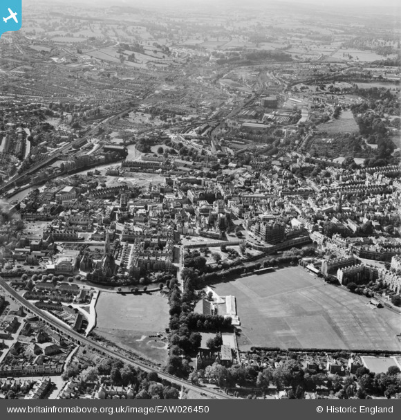
EAW026450 ENGLAND (1949). The city centre, Bath, from the east, 1949
    © Copyright OpenStreetMap contributors and licensed by the OpenStreetMap Foundation. 2025. Cartography is licensed as CC BY-SA.
  
Nearby Images (16)
Details
| Title | [EAW026450] The city centre, Bath, from the east, 1949 | 
| Reference | EAW026450 | 
| Date | 8-October-1949 | 
| Link | |
| Place name | BATH | 
| Parish | |
| District | |
| Country | ENGLAND | 
| Easting / Northing | 375453, 164740 | 
| Longitude / Latitude | -2.3527523302652, 51.380681235411 | 
| National Grid Reference | ST755647 | 
 
             
  ![[EAW026450] The city centre, Bath, from the east, 1949](http://britainfromabove.org.uk/sites/all/libraries/aerofilms-images/public/100x100/EAW/026/EAW026450.jpg) 
  
                                          ![[EPW048380] The city, Bath, from the east, 1935](http://britainfromabove.org.uk/sites/all/libraries/aerofilms-images/public/100x100/EPW/048/EPW048380.jpg) 
 ![[EPW048403] Bath and County Recreation Ground, the Cricket Ground and environs, Bath, 1935](http://britainfromabove.org.uk/sites/all/libraries/aerofilms-images/public/100x100/EPW/048/EPW048403.jpg) 
 ![[EAW023885] Parade Gardens and the city centre, Bath, 1949. This image has been produced from a print.](http://britainfromabove.org.uk/sites/all/libraries/aerofilms-images/public/100x100/EAW/023/EAW023885.jpg) 
 ![[EAW049898] Bath, the second day of the Somerset-Kent county cricket match, 1953](http://britainfromabove.org.uk/sites/all/libraries/aerofilms-images/public/100x100/EAW/049/EAW049898.jpg) 
 ![[EPW001957] General view of the town centre, Bath, from the east, 1920](http://britainfromabove.org.uk/sites/all/libraries/aerofilms-images/public/100x100/EPW/001/EPW001957.jpg) 
 ![[EAW049899] Bath, the second day of the Somerset-Kent county cricket match, 1953](http://britainfromabove.org.uk/sites/all/libraries/aerofilms-images/public/100x100/EAW/049/EAW049899.jpg) 
 ![[EAW049901] Bath, the second day of the Somerset-Kent county cricket match, 1953](http://britainfromabove.org.uk/sites/all/libraries/aerofilms-images/public/100x100/EAW/049/EAW049901.jpg) 
 ![[EAW000755] The Church of St John the Evangelist, Abbey Church of St Peter and St Paul and surrounding city, Bath, 1946](http://britainfromabove.org.uk/sites/all/libraries/aerofilms-images/public/100x100/EAW/000/EAW000755.jpg) 
 ![[EAW023884] North Parade Bridge and the city centre, Bath, 1949. This image has been produced from a print.](http://britainfromabove.org.uk/sites/all/libraries/aerofilms-images/public/100x100/EAW/023/EAW023884.jpg) 
 ![[EAW023882] The Abbey Church of St Peter and St Paul and the city centre, Bath, from the south-east, 1949. This image has been produced from a print.](http://britainfromabove.org.uk/sites/all/libraries/aerofilms-images/public/100x100/EAW/023/EAW023882.jpg) 
 ![[EAW000758] North Parade looking towards the railway station, Bath, 1946](http://britainfromabove.org.uk/sites/all/libraries/aerofilms-images/public/100x100/EAW/000/EAW000758.jpg) 
 ![[EPW048402] Bath and County Recreation Ground, the Cricket Ground and environs, Bath, 1935](http://britainfromabove.org.uk/sites/all/libraries/aerofilms-images/public/100x100/EPW/048/EPW048402.jpg) 
 ![[EPW048377] The city, Bath, from the north-east, 1935](http://britainfromabove.org.uk/sites/all/libraries/aerofilms-images/public/100x100/EPW/048/EPW048377.jpg) 
 ![[EAW000757] The Abbey Church of St Peter and St Paul looking towards St James's Bridge, Bath, 1946](http://britainfromabove.org.uk/sites/all/libraries/aerofilms-images/public/100x100/EAW/000/EAW000757.jpg) 
 ![[EPW001950] The Weir and Parade Gardens, Bath, 1920](http://britainfromabove.org.uk/sites/all/libraries/aerofilms-images/public/100x100/EPW/001/EPW001950.jpg) 
  War Memorial, Bath, 15/07/2014
 War Memorial, Bath, 15/07/2014