
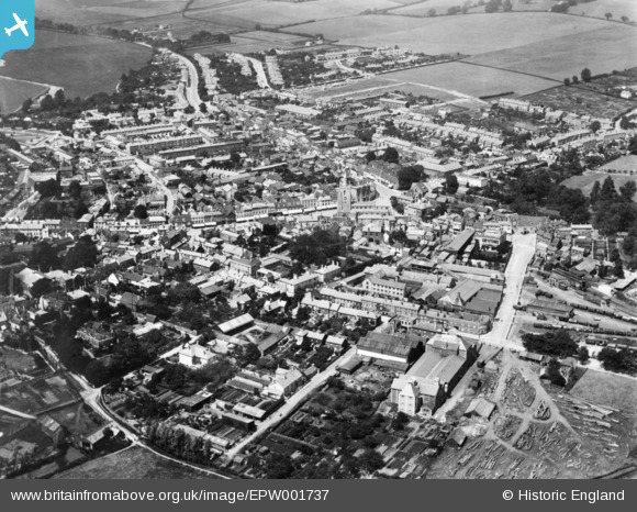
EPW001737 ENGLAND (1920). The town, Sudbury, 1920. This image has been produced from a copy-negative.
© Copyright OpenStreetMap contributors and licensed by the OpenStreetMap Foundation. 2026. Cartography is licensed as CC BY-SA.
Nearby Images (19)
EPW001737

EAW042074

EPW025900

EAW042077

EAW042078

EPW025896

EPW025895

EPW001739

EAW029735

EAW029736

EAW042085

EAW042076

EAW042075

EAW042080

EAW042084

EAW042079

EAW042081

EAW042083

EAW042082

Details
| Title | [EPW001737] The town, Sudbury, 1920. This image has been produced from a copy-negative. |
| Reference | EPW001737 |
| Date | June-1920 |
| Link | |
| Place name | SUDBURY |
| Parish | SUDBURY |
| District | |
| Country | ENGLAND |
| Easting / Northing | 587439, 241233 |
| Longitude / Latitude | 0.73312384071635, 52.037346254646 |
| National Grid Reference | TL874412 |
Pins
Be the first to add a comment to this image!