
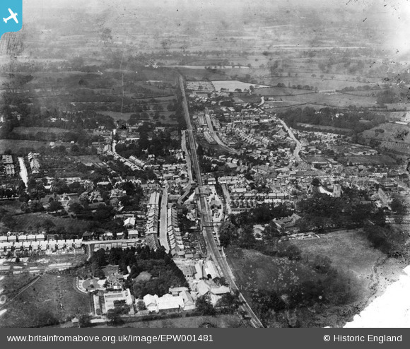
EPW001481 ENGLAND (1920). General view of the town, Crawley, from the east, 1920
© Copyright OpenStreetMap contributors and licensed by the OpenStreetMap Foundation. 2026. Cartography is licensed as CC BY-SA.
Nearby Images (10)
EPW001481

EPW028574

EAW041928

EPW001485

EPW028572

EPW028569

EAW037052

EPW001483

EAW011066

EPW028573

Details
| Title | [EPW001481] General view of the town, Crawley, from the east, 1920 |
| Reference | EPW001481 |
| Date | June-1920 |
| Link | |
| Place name | CRAWLEY |
| Parish | |
| District | |
| Country | ENGLAND |
| Easting / Northing | 526674, 136414 |
| Longitude / Latitude | -0.19012960283309, 51.112472591889 |
| National Grid Reference | TQ267364 |
Pins

Helen |
Friday 22nd of May 2020 09:47:09 PM | |
|
Alpineblond |
Tuesday 2nd of August 2016 10:30:19 PM | |

Class31 |
Thursday 1st of November 2012 08:48:22 PM | |
|
Class31 |
Thursday 1st of November 2012 08:47:29 PM | |
|
Class31 |
Thursday 1st of November 2012 08:46:55 PM | |
|
Class31 |
Thursday 1st of November 2012 08:45:56 PM | |
|
Class31 |
Thursday 1st of November 2012 08:45:04 PM | |
|
Class31 |
Thursday 1st of November 2012 08:44:30 PM |
User Comment Contributions

Crawley town, station and goods yard. |
tomoliver |
Saturday 1st of September 2012 05:43:45 PM |