
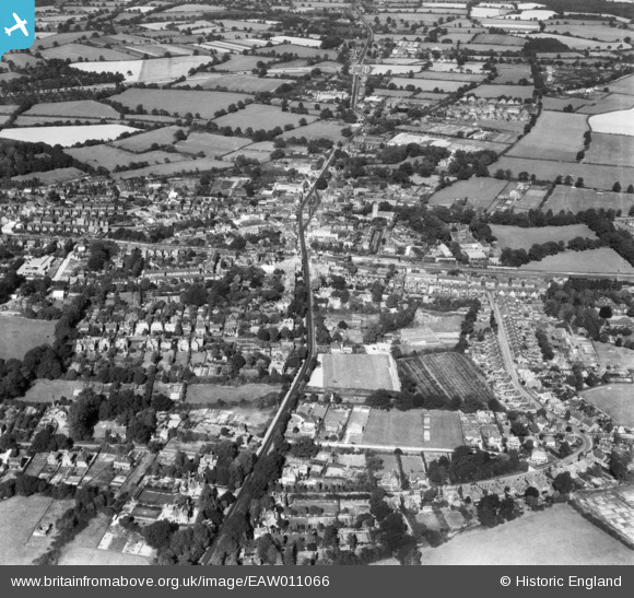
EAW011066 ENGLAND (1947). The town, Crawley, 1947
© Copyright OpenStreetMap contributors and licensed by the OpenStreetMap Foundation. 2026. Cartography is licensed as CC BY-SA.
Nearby Images (11)
EAW011066

EPW028569

EPW028573

EAW041928

EPW028574

EPW001481

EPW028576

EPW001485

EPW028572

EAW037052

EAW022731

Details
| Title | [EAW011066] The town, Crawley, 1947 |
| Reference | EAW011066 |
| Date | 25-September-1947 |
| Link | |
| Place name | CRAWLEY |
| Parish | |
| District | |
| Country | ENGLAND |
| Easting / Northing | 526758, 136265 |
| Longitude / Latitude | -0.18898245012937, 51.111114712293 |
| National Grid Reference | TQ268363 |
Pins

Bob |
Friday 15th of October 2021 12:45:11 AM | |
|
gBr |
Monday 12th of October 2015 09:39:04 PM | |
|
Dan Gregory |
Wednesday 3rd of December 2014 07:56:45 PM |