
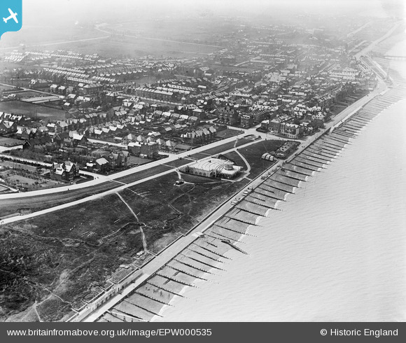
EPW000535 ENGLAND (1920). Kings Hall, Herne Bay, 1920
© Copyright OpenStreetMap contributors and licensed by the OpenStreetMap Foundation. 2026. Cartography is licensed as CC BY-SA.
Nearby Images (12)
EPW000535

EPW009206

EPW035495

EPW035498

EPW009205

EPW039301

EPW009203A

EPW035492

EPW039386

EPW054045

EPW035496

EPW000537

Details
| Title | [EPW000535] Kings Hall, Herne Bay, 1920 |
| Reference | EPW000535 |
| Date | April-1920 |
| Link | |
| Place name | HERNE BAY |
| Parish | |
| District | |
| Country | ENGLAND |
| Easting / Northing | 618407, 168381 |
| Longitude / Latitude | 1.1383563051065, 51.371913814744 |
| National Grid Reference | TR184684 |
Pins
Be the first to add a comment to this image!