
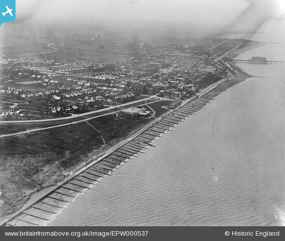
EPW000537 ENGLAND (1920). Herne Bay, from the north-west, 1920
© Copyright OpenStreetMap contributors and licensed by the OpenStreetMap Foundation. 2026. Cartography is licensed as CC BY-SA.
Nearby Images (10)
EPW000537

EPW009203A

EPW039386

EPW039301

EPW009205

EPW009206

EPW035495

EPW000535

EPW035492

EPW035498

Details
| Title | [EPW000537] Herne Bay, from the north-west, 1920 |
| Reference | EPW000537 |
| Date | April-1920 |
| Link | |
| Place name | HERNE BAY |
| Parish | |
| District | |
| Country | ENGLAND |
| Easting / Northing | 618603, 168474 |
| Longitude / Latitude | 1.1412253455131, 51.372673460529 |
| National Grid Reference | TR186685 |
Pins
Be the first to add a comment to this image!
User Comment Contributions
This photo was taken from the north-EAST as it is looking south-west across the town and the pier |

Mike Enfield |
Thursday 5th of July 2012 08:24:39 PM |