
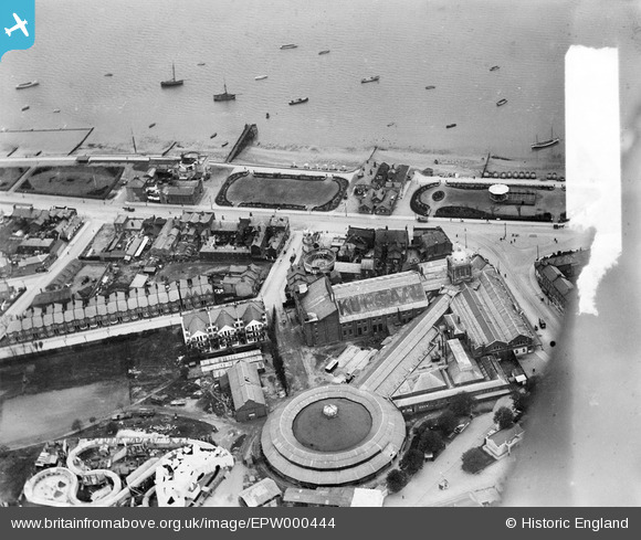
EPW000444 ENGLAND (1920). Kursaal, Southend-on-Sea, 1920
© Copyright OpenStreetMap contributors and licensed by the OpenStreetMap Foundation. 2026. Cartography is licensed as CC BY-SA.
Nearby Images (48)
EPW000444

EPW062745

EAW024660

EPW036726

EPW058226

EPW040987

EPW036730

EPW036612

EPW000443

EAW053086

EPW036995

EPW058224

EAW002192

EPW032920

EAW024659

EPW036615

EPW062743

EPW032919

EPW036616

EPW062744

EPW037003

EPW058222

EPW024869

EPW036978

EAW002219

EPW039864

EPW039862

EPW024890

EPW062747

EPW036977

EPW036617

EPW036981

EPW036980

EPW032924

EPW058223

EPW036976

EPW058443

EPW036614

EPW058225

EPW032925

EPW058446

EPW032921

EPW058447

EPW039861

EAW002194

EPW037016

EPW058445

EPW010871

Details
| Title | [EPW000444] Kursaal, Southend-on-Sea, 1920 |
| Reference | EPW000444 |
| Date | April-1920 |
| Link | |
| Place name | SOUTHEND-ON-SEA |
| Parish | |
| District | |
| Country | ENGLAND |
| Easting / Northing | 589119, 185036 |
| Longitude / Latitude | 0.72696272077836, 51.532027633312 |
| National Grid Reference | TQ891850 |
Pins
Be the first to add a comment to this image!