
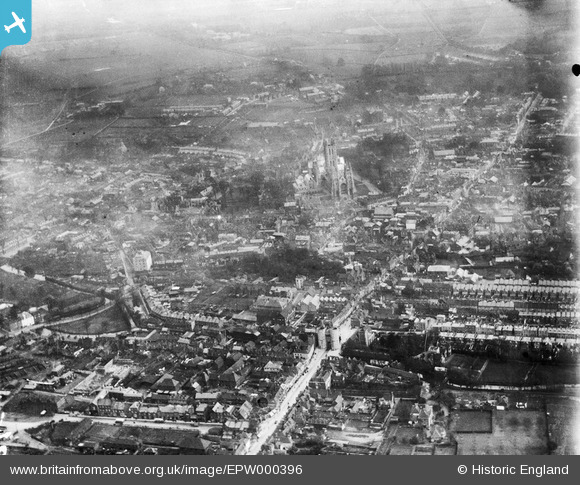
EPW000396 ENGLAND (1920). Canterbury, Kent, from the west, 1920
© Copyright OpenStreetMap contributors and licensed by the OpenStreetMap Foundation. 2026. Cartography is licensed as CC BY-SA.
Nearby Images (5)
EPW000396

EPW013267

EPW009148

EAW004803

EAW004804

Details
| Title | [EPW000396] Canterbury, Kent, from the west, 1920 |
| Reference | EPW000396 |
| Date | April-1920 |
| Link | |
| Place name | CANTERBURY |
| Parish | |
| District | |
| Country | ENGLAND |
| Easting / Northing | 614638, 158111 |
| Longitude / Latitude | 1.0780972344982, 51.281128832027 |
| National Grid Reference | TR146581 |
Pins

Stewart Lawrie |
Sunday 25th of June 2023 05:27:39 PM | |
|
Marian |
Sunday 8th of May 2016 03:10:49 PM | |
|
hnritchie |
Thursday 28th of August 2014 10:52:51 AM | |
|
hnritchie |
Thursday 28th of August 2014 10:49:39 AM | |

Alan McFaden |
Thursday 10th of July 2014 01:00:22 PM | |
|
EZTD |
Friday 29th of June 2012 09:51:33 PM | |
|
EZTD |
Friday 29th of June 2012 09:50:57 PM | |
|
EZTD |
Friday 29th of June 2012 09:50:06 PM | |
|
EZTD |
Friday 29th of June 2012 09:49:35 PM |

