
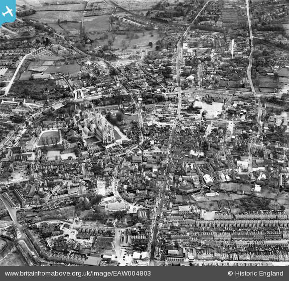
EAW004803 ENGLAND (1947). The city centre, Canterbury, from the north-east, 1947
© Copyright OpenStreetMap contributors and licensed by the OpenStreetMap Foundation. 2026. Cartography is licensed as CC BY-SA.
Nearby Images (9)
EAW004803

EPW009148

EAW004804

EPW000396

EPW013267

EAW028822

EAW017600

EPW009143

EAW014335

Details
| Title | [EAW004803] The city centre, Canterbury, from the north-east, 1947 |
| Reference | EAW004803 |
| Date | 25-April-1947 |
| Link | |
| Place name | CANTERBURY |
| Parish | |
| District | |
| Country | ENGLAND |
| Easting / Northing | 614767, 157982 |
| Longitude / Latitude | 1.0798667987271, 51.279921815484 |
| National Grid Reference | TR148580 |
Pins

RayG |
Wednesday 27th of October 2021 10:47:41 PM | |
|
Tom |
Saturday 27th of June 2020 12:11:15 PM | |
|
Tom |
Saturday 27th of June 2020 12:08:22 PM | |

Alan McFaden |
Friday 11th of July 2014 09:00:32 AM | |
|
Alan McFaden |
Thursday 10th of July 2014 01:20:19 PM | |
|
Alan McFaden |
Thursday 10th of July 2014 01:19:47 PM | |
|
Alan McFaden |
Thursday 10th of July 2014 01:18:54 PM | |
|
Alan McFaden |
Thursday 10th of July 2014 01:18:08 PM |


