
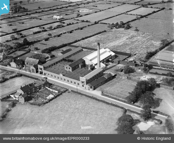
EPR000233 ENGLAND (1934). The Sovereign Confectionery Mills, Lowton, 1934. This image was marked by Aero Pictorial Ltd for photo editing.
© Copyright OpenStreetMap contributors and licensed by the OpenStreetMap Foundation. 2026. Cartography is licensed as CC BY-SA.
Nearby Images (5)
EPR000233

EPR000232

EPR000229

EPR000230

EPR000231

Details
| Title | [EPR000233] The Sovereign Confectionery Mills, Lowton, 1934. This image was marked by Aero Pictorial Ltd for photo editing. |
| Reference | EPR000233 |
| Date | 14-August-1934 |
| Link | |
| Place name | LOWTON |
| Parish | |
| District | |
| Country | ENGLAND |
| Easting / Northing | 362063, 397166 |
| Longitude / Latitude | -2.5715708973676, 53.469608888942 |
| National Grid Reference | SJ621972 |
Pins
Be the first to add a comment to this image!