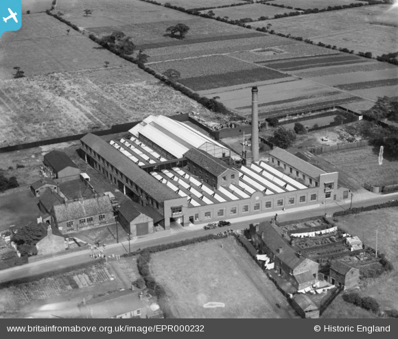
EPR000232 ENGLAND (1934). The Sovereign Confectionery Mills, Lowton, 1934. This image was marked by Aero Pictorial Ltd for photo editing.
© Copyright OpenStreetMap contributors and licensed by the OpenStreetMap Foundation. 2026. Cartography is licensed as CC BY-SA.
Nearby Images (5)
Details
| Title | [EPR000232] The Sovereign Confectionery Mills, Lowton, 1934. This image was marked by Aero Pictorial Ltd for photo editing. |
| Reference | EPR000232 |
| Date | 14-August-1934 |
| Link | |
| Place name | LOWTON |
| Parish | |
| District | |
| Country | ENGLAND |
| Easting / Northing | 362059, 397177 |
| Longitude / Latitude | -2.5716324879435, 53.469707480349 |
| National Grid Reference | SJ621972 |
Pins

Mark |
Saturday 12th of February 2022 02:09:53 PM |


![[EPR000232] The Sovereign Confectionery Mills, Lowton, 1934. This image was marked by Aero Pictorial Ltd for photo editing.](http://britainfromabove.org.uk/sites/all/libraries/aerofilms-images/public/100x100/EPR/000/EPR000232.jpg)
![[EPR000229] The Sovereign Confectionery Mills, Lowton, 1934. This image was marked by Aero Pictorial Ltd for photo editing.](http://britainfromabove.org.uk/sites/all/libraries/aerofilms-images/public/100x100/EPR/000/EPR000229.jpg)
![[EPR000233] The Sovereign Confectionery Mills, Lowton, 1934. This image was marked by Aero Pictorial Ltd for photo editing.](http://britainfromabove.org.uk/sites/all/libraries/aerofilms-images/public/100x100/EPR/000/EPR000233.jpg)
![[EPR000230] The Sovereign Confectionery Mills, Lowton, 1934](http://britainfromabove.org.uk/sites/all/libraries/aerofilms-images/public/100x100/EPR/000/EPR000230.jpg)
![[EPR000231] The Sovereign Confectionery Mills, Lowton, 1934](http://britainfromabove.org.uk/sites/all/libraries/aerofilms-images/public/100x100/EPR/000/EPR000231.jpg)