
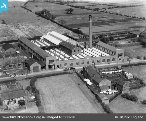
EPR000230 ENGLAND (1934). The Sovereign Confectionery Mills, Lowton, 1934
© Copyright OpenStreetMap contributors and licensed by the OpenStreetMap Foundation. 2026. Cartography is licensed as CC BY-SA.
Nearby Images (5)
EPR000230

EPR000229

EPR000232

EPR000233

EPR000231

Details
| Title | [EPR000230] The Sovereign Confectionery Mills, Lowton, 1934 |
| Reference | EPR000230 |
| Date | 14-August-1934 |
| Link | |
| Place name | LOWTON |
| Parish | |
| District | |
| Country | ENGLAND |
| Easting / Northing | 362046, 397166 |
| Longitude / Latitude | -2.5718270107711, 53.469607663675 |
| National Grid Reference | SJ620972 |
Pins
Be the first to add a comment to this image!