
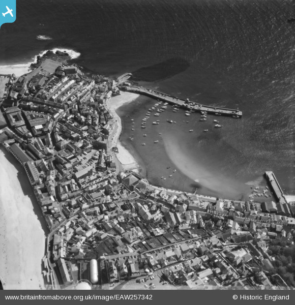
EAW257342 ENGLAND (1973). The harbour and town, St Ives, 1973
© Copyright OpenStreetMap contributors and licensed by the OpenStreetMap Foundation. 2026. Cartography is licensed as CC BY-SA.
Nearby Images (10)
EAW257342

EPW021752

EPW039835

EPW021747

EPW021748

EPW039834

EPW021745

EPW021744

EPW059855

EPW059854

Details
| Title | [EAW257342] The harbour and town, St Ives, 1973 |
| Reference | EAW257342 |
| Date | 10-May-1973 |
| Link | |
| Place name | ST IVES |
| Parish | ST. IVES |
| District | |
| Country | ENGLAND |
| Easting / Northing | 151973, 40752 |
| Longitude / Latitude | -5.4770005866146, 50.214074853605 |
| National Grid Reference | SW520408 |
Pins

Matt Aldred edob.mattaldred.com |
Saturday 5th of December 2020 02:18:01 PM | |

redmist |
Saturday 18th of July 2020 02:43:41 PM |