
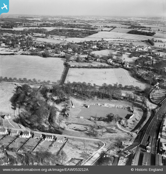
EAW053212A ENGLAND (1954). The remains of Berkhamsted Castle and environs, Berkhamsted, from the west, 1954
© Copyright OpenStreetMap contributors and licensed by the OpenStreetMap Foundation. 2026. Cartography is licensed as CC BY-SA.
Nearby Images (23)
EAW053212A

EAW014227

EAW014222

EAW014228

EAW049279

EAW004823

EAW004824

EAW048760

EAW053209

EAW004826

EAW049276

EAW048761

EAW049278

EAW004825

EAW014225

EAW014224

EAW048762

EAW014226

EAW053211

EAW053210

EAW048763

EAW014223

EAW049277

Details
| Title | [EAW053212A] The remains of Berkhamsted Castle and environs, Berkhamsted, from the west, 1954 |
| Reference | EAW053212A |
| Date | 10-March-1954 |
| Link | |
| Place name | BERKHAMSTED |
| Parish | BERKHAMSTED |
| District | |
| Country | ENGLAND |
| Easting / Northing | 499436, 208260 |
| Longitude / Latitude | -0.55896232393055, 51.763728201854 |
| National Grid Reference | SP994083 |
Pins

John Wass |
Wednesday 9th of November 2016 03:09:17 PM |