
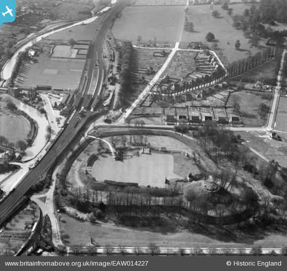
EAW014227 ENGLAND (1948). Berkhamsted Castle and the Railway Station, Berkhamsted, 1948
© Copyright OpenStreetMap contributors and licensed by the OpenStreetMap Foundation. 2026. Cartography is licensed as CC BY-SA.
Nearby Images (24)
EAW014227

EAW053212A

EAW014222

EAW048761

EAW049279

EAW004823

EAW014228

EAW053209

EAW048762

EAW004824

EAW048760

EAW053210

EAW014226

EAW004826

EAW014225

EAW049276

EAW004825

EAW014224

EAW049278

EAW053211

EAW048763

EAW014223

EAW049277

EAW041753

Details
| Title | [EAW014227] Berkhamsted Castle and the Railway Station, Berkhamsted, 1948 |
| Reference | EAW014227 |
| Date | 9-April-1948 |
| Link | |
| Place name | BERKHAMSTED |
| Parish | BERKHAMSTED |
| District | |
| Country | ENGLAND |
| Easting / Northing | 499404, 208241 |
| Longitude / Latitude | -0.55943135049252, 51.763563088931 |
| National Grid Reference | SP994082 |
Pins

John Wass |
Wednesday 13th of May 2015 11:54:43 AM | |
|
Gavin Thomas |
Thursday 28th of August 2014 04:49:52 PM |