
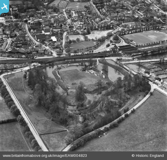
EAW004823 ENGLAND (1947). Berkhamsted Castle, Berkhamstead, 1947. This image has been produced from a print.
© Copyright OpenStreetMap contributors and licensed by the OpenStreetMap Foundation. 2026. Cartography is licensed as CC BY-SA.
Nearby Images (24)
EAW004823

EAW049279

EAW004824

EAW014222

EAW014226

EAW014225

EAW004825

EAW014224

EAW053209

EAW049276

EAW004826

EAW014228

EAW053212A

EAW053210

EAW048760

EAW049278

EAW014227

EAW048762

EAW048763

EAW053211

EAW014223

EAW048761

EAW049277

EAW041753

Details
| Title | [EAW004823] Berkhamsted Castle, Berkhamstead, 1947. This image has been produced from a print. |
| Reference | EAW004823 |
| Date | 29-April-1947 |
| Link | |
| Place name | BERKHAMSTED |
| Parish | BERKHAMSTED |
| District | |
| Country | ENGLAND |
| Easting / Northing | 499497, 208217 |
| Longitude / Latitude | -0.55809092335593, 51.763330825774 |
| National Grid Reference | SP995082 |
Pins

Matt Aldred edob.mattaldred.com |
Saturday 4th of June 2022 11:23:02 PM | |

John Wass |
Wednesday 9th of November 2016 02:40:01 PM |