
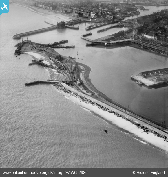
EAW052980 ENGLAND (1953). The Outer Harbour, North Beach and Waveney Dock, Lowestoft, 1953
© Copyright OpenStreetMap contributors and licensed by the OpenStreetMap Foundation. 2026. Cartography is licensed as CC BY-SA.
Nearby Images (6)
EAW052980

EPW021254

EAW005065

EAW052977

EAW047638

EAW047642

Details
| Title | [EAW052980] The Outer Harbour, North Beach and Waveney Dock, Lowestoft, 1953 |
| Reference | EAW052980 |
| Date | 19-November-1953 |
| Link | |
| Place name | LOWESTOFT |
| Parish | |
| District | |
| Country | ENGLAND |
| Easting / Northing | 655409, 292936 |
| Longitude / Latitude | 1.7613339775909, 52.474109250425 |
| National Grid Reference | TM554929 |
Pins

cptpies |
Friday 21st of November 2014 08:42:20 AM |
User Comment Contributions

AT blocks being re-used as sea defences. |
cptpies |
Friday 21st of November 2014 08:43:18 AM |