
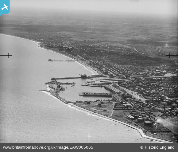
EAW005065 ENGLAND (1947). The Outer Harbour, Waveney Dock, Hamilton Dock and environs, Lowestoft, from the north-east, 1947
© Copyright OpenStreetMap contributors and licensed by the OpenStreetMap Foundation. 2026. Cartography is licensed as CC BY-SA.
Nearby Images (5)
EAW005065

EAW052977

EPW021254

EAW052980

EAW047642

Details
| Title | [EAW005065] The Outer Harbour, Waveney Dock, Hamilton Dock and environs, Lowestoft, from the north-east, 1947 |
| Reference | EAW005065 |
| Date | 11-May-1947 |
| Link | |
| Place name | LOWESTOFT |
| Parish | |
| District | |
| Country | ENGLAND |
| Easting / Northing | 655291, 293061 |
| Longitude / Latitude | 1.7596960045672, 52.475285890707 |
| National Grid Reference | TM553931 |
Pins
Be the first to add a comment to this image!