
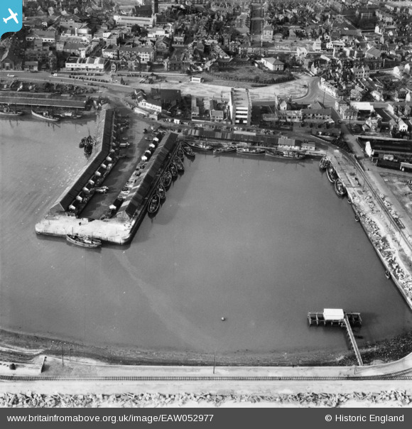
EAW052977 ENGLAND (1953). Hamilton Dock, Lowestoft, 1953
© Copyright OpenStreetMap contributors and licensed by the OpenStreetMap Foundation. 2026. Cartography is licensed as CC BY-SA.
Nearby Images (6)
EAW052977

EAW005065

EPW021254

EAW052980

EAW047642

EPW016550

Details
| Title | [EAW052977] Hamilton Dock, Lowestoft, 1953 |
| Reference | EAW052977 |
| Date | 19-November-1953 |
| Link | |
| Place name | LOWESTOFT |
| Parish | |
| District | |
| Country | ENGLAND |
| Easting / Northing | 655305, 293090 |
| Longitude / Latitude | 1.759923909446, 52.475539522174 |
| National Grid Reference | TM553931 |
Pins

Brightonboy |
Friday 29th of January 2021 09:07:39 PM | |
|
Brightonboy |
Friday 29th of January 2021 09:06:38 PM | |
|
Brightonboy |
Friday 29th of January 2021 09:05:35 PM | |
|
Brightonboy |
Friday 29th of January 2021 09:03:28 PM | |
|
Brightonboy |
Friday 29th of January 2021 09:01:31 PM | |
|
Eddy |
Tuesday 18th of August 2020 09:23:58 PM | |
|
Eddy |
Tuesday 18th of August 2020 09:21:23 PM | |
|
Eddy |
Tuesday 18th of August 2020 09:12:35 PM | |
|
Eddy |
Tuesday 18th of August 2020 09:10:46 PM | |
|
Eddy |
Tuesday 18th of August 2020 09:09:44 PM | |
|
Eddy |
Tuesday 18th of August 2020 09:07:59 PM | |
|
356 |
Monday 27th of January 2020 04:01:16 PM | |
|
356 |
Monday 27th of January 2020 03:59:55 PM | |
|
356 |
Monday 27th of January 2020 03:57:24 PM | |
|
356 |
Monday 27th of January 2020 03:54:22 PM | |
|
356 |
Monday 27th of January 2020 03:52:54 PM | |
|
356 |
Monday 27th of January 2020 03:52:37 PM |