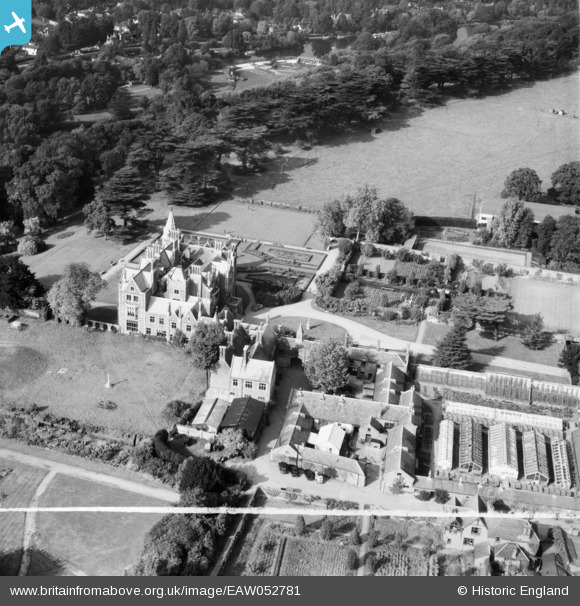
EAW052781 ENGLAND (1953). Taplow Court, Taplow, 1953. This image was marked by Aerofilms Ltd for photo editing.
© Copyright OpenStreetMap contributors and licensed by the OpenStreetMap Foundation. 2025. Cartography is licensed as CC BY-SA.
Nearby Images (7)
Details
| Title | [EAW052781] Taplow Court, Taplow, 1953. This image was marked by Aerofilms Ltd for photo editing. |
| Reference | EAW052781 |
| Date | 9-October-1953 |
| Link | |
| Place name | TAPLOW |
| Parish | TAPLOW |
| District | |
| Country | ENGLAND |
| Easting / Northing | 490656, 182241 |
| Longitude / Latitude | -0.6929106245824, 51.531310053039 |
| National Grid Reference | SU907822 |
Pins
Be the first to add a comment to this image!


![[EAW052781] Taplow Court, Taplow, 1953. This image was marked by Aerofilms Ltd for photo editing.](http://britainfromabove.org.uk/sites/all/libraries/aerofilms-images/public/100x100/EAW/052/EAW052781.jpg)
![[EAW052777] Taplow Court, Taplow, 1953](http://britainfromabove.org.uk/sites/all/libraries/aerofilms-images/public/100x100/EAW/052/EAW052777.jpg)
![[EAW052780] Taplow Court, Taplow, 1953. This image was marked by Aerofilms Ltd for photo editing.](http://britainfromabove.org.uk/sites/all/libraries/aerofilms-images/public/100x100/EAW/052/EAW052780.jpg)
![[EAW052775] Taplow Court, Taplow, 1953](http://britainfromabove.org.uk/sites/all/libraries/aerofilms-images/public/100x100/EAW/052/EAW052775.jpg)
![[EAW052782] Taplow Court, Taplow, 1953. This image was marked by Aerofilms Ltd for photo editing.](http://britainfromabove.org.uk/sites/all/libraries/aerofilms-images/public/100x100/EAW/052/EAW052782.jpg)
![[EAW052776] Taplow Court and environs, Taplow, 1953](http://britainfromabove.org.uk/sites/all/libraries/aerofilms-images/public/100x100/EAW/052/EAW052776.jpg)
![[EAW052778] Taplow Court, Taplow, 1953](http://britainfromabove.org.uk/sites/all/libraries/aerofilms-images/public/100x100/EAW/052/EAW052778.jpg)