
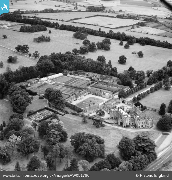
EAW051766 ENGLAND (1953). Hinchingbrooke House and Park, Huntingdon, 1953
© Copyright OpenStreetMap contributors and licensed by the OpenStreetMap Foundation. 2026. Cartography is licensed as CC BY-SA.
Nearby Images (12)
EAW051766

EAW051765

EAW021161

EAW021165

EAW051764

EAW021163

EAW021162

EAW021164

EPW041332

EPW009844

EAW021166

EPW014428

Details
| Title | [EAW051766] Hinchingbrooke House and Park, Huntingdon, 1953 |
| Reference | EAW051766 |
| Date | 14-August-1953 |
| Link | |
| Place name | HUNTINGDON |
| Parish | HUNTINGDON |
| District | |
| Country | ENGLAND |
| Easting / Northing | 522687, 271606 |
| Longitude / Latitude | -0.19942395032694, 52.328424574712 |
| National Grid Reference | TL227716 |
Pins
Be the first to add a comment to this image!