
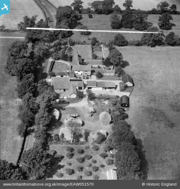
EAW051570 ENGLAND (1953). Cranley Manor, Eye, 1953. This image was marked by Aerofilms Ltd for photo editing.
© Copyright OpenStreetMap contributors and licensed by the OpenStreetMap Foundation. 2025. Cartography is licensed as CC BY-SA.
Nearby Images (14)
EAW051570

EAW051573

EAW051569

EAW051575

EAW051574

EAW051568

EAW051571

EAW051572

EAW016367

EAW016364

EAW016366

EAW016363

EAW016368

EAW016365

Details
| Title | [EAW051570] Cranley Manor, Eye, 1953. This image was marked by Aerofilms Ltd for photo editing. |
| Reference | EAW051570 |
| Date | 26-August-1953 |
| Link | |
| Place name | EYE |
| Parish | EYE |
| District | |
| Country | ENGLAND |
| Easting / Northing | 616455, 272691 |
| Longitude / Latitude | 1.1756334517735, 52.309203109111 |
| National Grid Reference | TM165727 |
Pins
Be the first to add a comment to this image!