
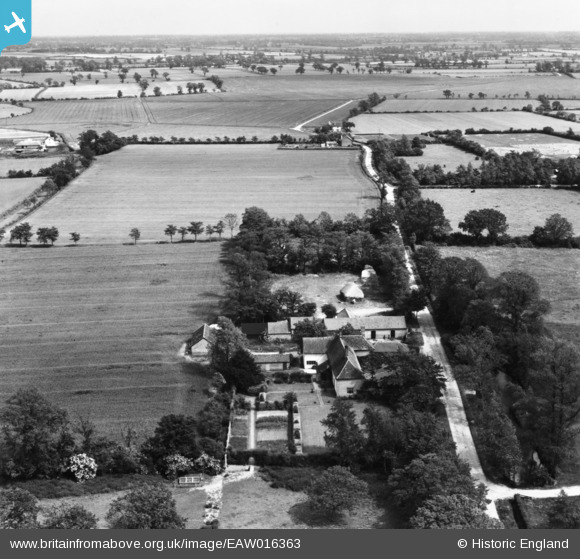
EAW016363 ENGLAND (1948). Cranley Manor, Cranley, from the north-west, 1948. This image has been produced from a print.
© Copyright OpenStreetMap contributors and licensed by the OpenStreetMap Foundation. 2025. Cartography is licensed as CC BY-SA.
Nearby Images (14)
EAW016363

EAW016364

EAW016368

EAW016365

EAW051568

EAW016367

EAW051571

EAW051569

EAW051570

EAW016366

EAW051575

EAW051573

EAW051574

EAW051572

Details
| Title | [EAW016363] Cranley Manor, Cranley, from the north-west, 1948. This image has been produced from a print. |
| Reference | EAW016363 |
| Date | 8-June-1948 |
| Link | |
| Place name | CRANLEY |
| Parish | EYE |
| District | |
| Country | ENGLAND |
| Easting / Northing | 616393, 272718 |
| Longitude / Latitude | 1.1747427155902, 52.309469934148 |
| National Grid Reference | TM164727 |
Pins

HBMil |
Monday 29th of March 2021 10:16:40 PM | |
|
HBMil |
Monday 29th of March 2021 10:13:32 PM | |
|
HBMil |
Monday 29th of March 2021 10:12:44 PM | |
|
HBMil |
Monday 29th of March 2021 10:10:58 PM | |
|
HBMil |
Monday 29th of March 2021 10:01:48 PM | |
|
HBMil |
Monday 29th of March 2021 09:52:18 PM | |
|
HBMil |
Monday 29th of March 2021 09:51:52 PM | |
|
HBMil |
Monday 29th of March 2021 09:49:28 PM |