
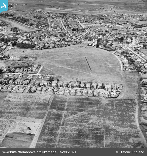
EAW051021 ENGLAND (1953). Ash Road and environs, Canvey Island, 1953
© Copyright OpenStreetMap contributors and licensed by the OpenStreetMap Foundation. 2026. Cartography is licensed as CC BY-SA.
Nearby Images (5)
EAW051021

EAW021069

EAW026935

EAW026934

EAW051022

Details
| Title | [EAW051021] Ash Road and environs, Canvey Island, 1953 |
| Reference | EAW051021 |
| Date | 3-August-1953 |
| Link | |
| Place name | CANVEY ISLAND |
| Parish | CANVEY ISLAND |
| District | |
| Country | ENGLAND |
| Easting / Northing | 580254, 183295 |
| Longitude / Latitude | 0.59838967094068, 51.51928798835 |
| National Grid Reference | TQ803833 |
Pins

ArtfulCopy |
Wednesday 15th of October 2025 08:15:23 PM |