
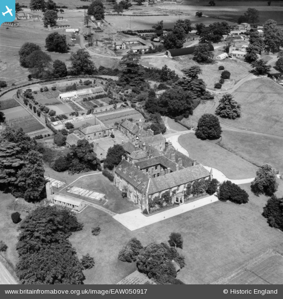
EAW050917 ENGLAND (1953). Chicksands Priory, Chicksands, 1953
© Copyright OpenStreetMap contributors and licensed by the OpenStreetMap Foundation. 2026. Cartography is licensed as CC BY-SA.
Nearby Images (6)
EAW050917

EAW050918

EAW000957

EAW000958

EAW000953

EAW000956

Details
| Title | [EAW050917] Chicksands Priory, Chicksands, 1953 |
| Reference | EAW050917 |
| Date | 25-July-1953 |
| Link | |
| Place name | CHICKSANDS |
| Parish | CAMPTON AND CHICKSANDS |
| District | |
| Country | ENGLAND |
| Easting / Northing | 512147, 239321 |
| Longitude / Latitude | -0.36472041948943, 52.040510287582 |
| National Grid Reference | TL121393 |
Pins

Matt Aldred edob.mattaldred.com |
Friday 8th of March 2024 01:59:17 PM | |

melgibbs |
Monday 6th of October 2014 10:41:34 AM | |
Chicksands Priory was sold by Sir Algernon Osborn, 7th Bt., to the Commissioners of Crown Lands, 15th April 1936. It remained as such until it was sold to the Ministry of Defence, 1st July 1962 with the benefit of all the existing leases. (Source: Crown Commissioners Archives) |

RWW |
Friday 17th of April 2015 11:52:21 PM |
|
melgibbs |
Monday 6th of October 2014 10:27:07 AM |
User Comment Contributions
RAF Chicksands was one of the "Y Stations" during WW2 intercepting enemy radio messages and passing them on to Bletchley Park. |
melgibbs |
Thursday 26th of February 2015 06:23:11 PM |