
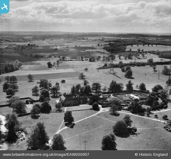
EAW000957 ENGLAND (1946). Chicksands Priory at RAF Chicksands and environs, Chicksands, from the north-east, 1946
© Copyright OpenStreetMap contributors and licensed by the OpenStreetMap Foundation. 2026. Cartography is licensed as CC BY-SA.
Nearby Images (6)
EAW000957

EAW000958

EAW050917

EAW000956

EAW050918

EAW000953

Details
| Title | [EAW000957] Chicksands Priory at RAF Chicksands and environs, Chicksands, from the north-east, 1946 |
| Reference | EAW000957 |
| Date | 28-May-1946 |
| Link | |
| Place name | CHICKSANDS |
| Parish | CAMPTON AND CHICKSANDS |
| District | |
| Country | ENGLAND |
| Easting / Northing | 512237, 239340 |
| Longitude / Latitude | -0.36340241841186, 52.040662844268 |
| National Grid Reference | TL122393 |
Pins

melgibbs |
Monday 6th of October 2014 10:33:58 AM |
User Comment Contributions
RAF Chicksands was one of the "Y Stations" during WW2 intercepting enemy radio messages and passing them on to Bletchley Park. |
melgibbs |
Thursday 26th of February 2015 06:27:34 PM |