
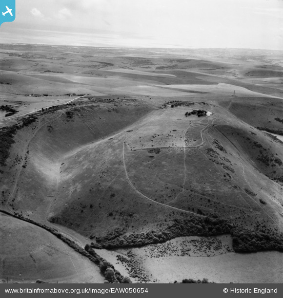
EAW050654 ENGLAND (1953). Devil's Dyke, Poynings, from the north-east, 1953
© Copyright OpenStreetMap contributors and licensed by the OpenStreetMap Foundation. 2026. Cartography is licensed as CC BY-SA.
Nearby Images (4)
EAW050654

EAW050658

EPW043888

EAW050653

Details
| Title | [EAW050654] Devil's Dyke, Poynings, from the north-east, 1953 |
| Reference | EAW050654 |
| Date | 15-July-1953 |
| Link | |
| Place name | POYNINGS |
| Parish | POYNINGS |
| District | |
| Country | ENGLAND |
| Easting / Northing | 526490, 111458 |
| Longitude / Latitude | -0.20145378315119, 50.888188256896 |
| National Grid Reference | TQ265115 |
Pins
Be the first to add a comment to this image!
User Comment Contributions
The Devil's Dyke |

Alan McFaden |
Sunday 16th of November 2014 10:46:41 AM |