
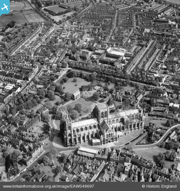
EAW049697 ENGLAND (1953). York Minster, York, 1953
© Copyright OpenStreetMap contributors and licensed by the OpenStreetMap Foundation. 2026. Cartography is licensed as CC BY-SA.
Nearby Images (15)
EAW049697

EAW000861

EAW000859

EAW000863

EAW000862

EAW009421

EAW049696

EAW003656

EPW016073

EAW005742

EAW009422

EAW005743

EAW009420

EPW016072

EAW049694

Details
| Title | [EAW049697] York Minster, York, 1953 |
| Reference | EAW049697 |
| Date | 24-May-1953 |
| Link | |
| Place name | YORK |
| Parish | |
| District | |
| Country | ENGLAND |
| Easting / Northing | 460344, 452342 |
| Longitude / Latitude | -1.0801187494928, 53.963438963866 |
| National Grid Reference | SE603523 |
Pins

NigelP |
Sunday 1st of December 2024 04:49:54 PM | |

Alan McFaden |
Thursday 5th of June 2014 05:23:43 PM | |
|
Alan McFaden |
Thursday 5th of June 2014 05:23:21 PM |

