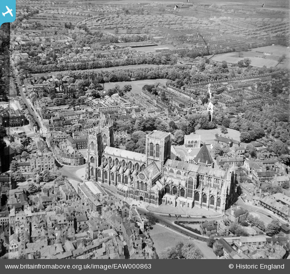
EAW000863 ENGLAND (1946). York Minster and environs, York, 1946
© Copyright OpenStreetMap contributors and licensed by the OpenStreetMap Foundation. 2026. Cartography is licensed as CC BY-SA.
Nearby Images (16)
Details
| Title | [EAW000863] York Minster and environs, York, 1946 |
| Reference | EAW000863 |
| Date | 15-May-1946 |
| Link | |
| Place name | YORK |
| Parish | |
| District | |
| Country | ENGLAND |
| Easting / Northing | 460233, 452343 |
| Longitude / Latitude | -1.0818103911196, 53.963460892545 |
| National Grid Reference | SE602523 |
Pins

Class31 |
Tuesday 16th of September 2014 11:49:32 AM | |

Class31 |
Wednesday 7th of May 2014 08:52:40 AM | |

Class31 |
Wednesday 7th of May 2014 08:38:34 AM | |

Alan McFaden |
Monday 16th of December 2013 11:09:00 PM | |

Alan McFaden |
Monday 16th of December 2013 11:08:32 PM | |

YorkStories |
Tuesday 27th of August 2013 04:21:51 PM | |

YorkStories |
Tuesday 27th of August 2013 04:17:51 PM | |

YorkStories |
Tuesday 27th of August 2013 04:17:05 PM | |

YorkStories |
Tuesday 27th of August 2013 04:16:21 PM | |

YorkStories |
Tuesday 27th of August 2013 04:06:39 PM | |

YorkStories |
Tuesday 27th of August 2013 04:04:35 PM |
User Comment Contributions

An original snapshot of York taken in June or July 1939. "The Minster , West Front " |

Class31 |
Wednesday 7th of May 2014 09:03:53 AM |

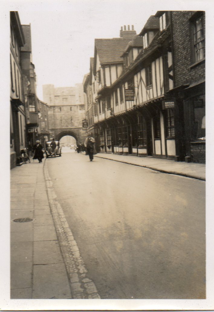
An original snapshot of York taken in June or July 1939. "High Petergate & Bootham Bar " |

Class31 |
Wednesday 7th of May 2014 08:53:02 AM |

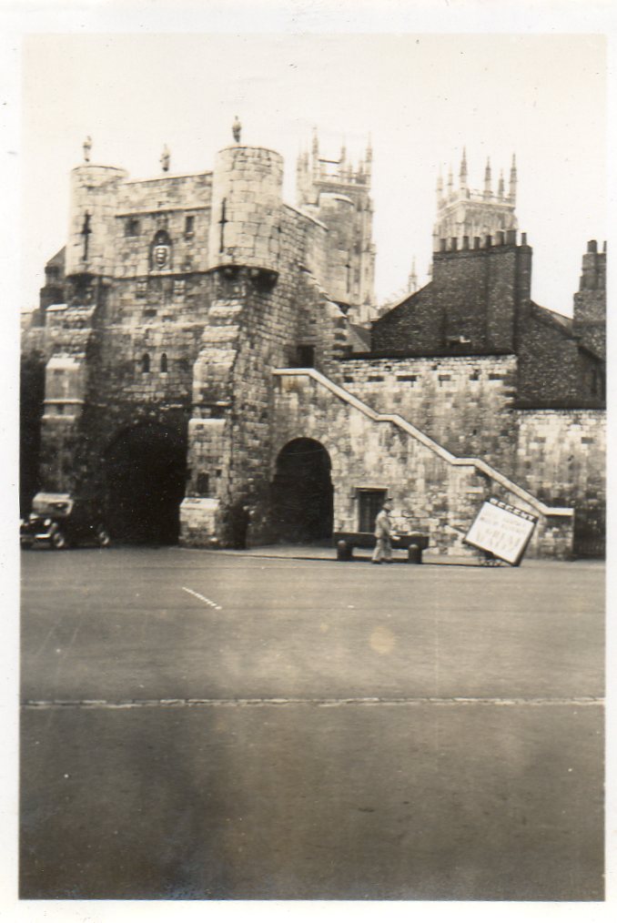
An original snapshot of York taken in June or July 1939. "Bootham Bar " |

Class31 |
Wednesday 7th of May 2014 08:38:58 AM |

YorkStories |
Saturday 31st of August 2013 11:10:28 AM |


![[EAW000863] York Minster and environs, York, 1946](http://britainfromabove.org.uk/sites/all/libraries/aerofilms-images/public/100x100/EAW/000/EAW000863.jpg)
![[EAW049696] York Minster, York, 1953](http://britainfromabove.org.uk/sites/all/libraries/aerofilms-images/public/100x100/EAW/049/EAW049696.jpg)
![[EAW049697] York Minster, York, 1953](http://britainfromabove.org.uk/sites/all/libraries/aerofilms-images/public/100x100/EAW/049/EAW049697.jpg)
![[EAW000859] York Minster, Minster Park and the city, York, 1946](http://britainfromabove.org.uk/sites/all/libraries/aerofilms-images/public/100x100/EAW/000/EAW000859.jpg)
![[EAW000862] York Minster and environs, York, 1946](http://britainfromabove.org.uk/sites/all/libraries/aerofilms-images/public/100x100/EAW/000/EAW000862.jpg)
![[EAW000861] York Minster, Minster Park and the city, York, 1946](http://britainfromabove.org.uk/sites/all/libraries/aerofilms-images/public/100x100/EAW/000/EAW000861.jpg)
![[EAW009420] York Minster, York, 1947. This image has been produced from a print.](http://britainfromabove.org.uk/sites/all/libraries/aerofilms-images/public/100x100/EAW/009/EAW009420.jpg)
![[EAW009421] York Minster, York, 1947. This image has been produced from a print.](http://britainfromabove.org.uk/sites/all/libraries/aerofilms-images/public/100x100/EAW/009/EAW009421.jpg)
![[EPW016073] York Minster, York, 1926](http://britainfromabove.org.uk/sites/all/libraries/aerofilms-images/public/100x100/EPW/016/EPW016073.jpg)
![[EAW009422] York Minster, York, 1947. This image has been produced from a print.](http://britainfromabove.org.uk/sites/all/libraries/aerofilms-images/public/100x100/EAW/009/EAW009422.jpg)
![[EAW005743] York Minster, York, 1947](http://britainfromabove.org.uk/sites/all/libraries/aerofilms-images/public/100x100/EAW/005/EAW005743.jpg)
![[EAW005742] York Minster, York, 1947](http://britainfromabove.org.uk/sites/all/libraries/aerofilms-images/public/100x100/EAW/005/EAW005742.jpg)
![[EAW049694] York Minster and the city, York, 1953](http://britainfromabove.org.uk/sites/all/libraries/aerofilms-images/public/100x100/EAW/049/EAW049694.jpg)
![[EPW016072] York Minster, York, 1926](http://britainfromabove.org.uk/sites/all/libraries/aerofilms-images/public/100x100/EPW/016/EPW016072.jpg)
![[EAW003656] York Minster and the city, York, from the north-west, 1947](http://britainfromabove.org.uk/sites/all/libraries/aerofilms-images/public/100x100/EAW/003/EAW003656.jpg)
![[EAW002151] The city, York, from the west, 1946](http://britainfromabove.org.uk/sites/all/libraries/aerofilms-images/public/100x100/EAW/002/EAW002151.jpg)


