
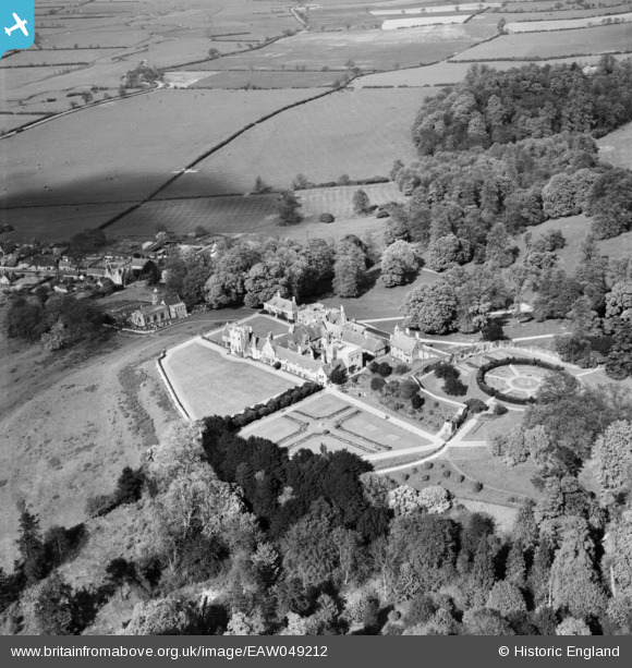
EAW049212 ENGLAND (1953). Rockingham Castle and St Leonard's Church, Rockingham, 1953
© Copyright OpenStreetMap contributors and licensed by the OpenStreetMap Foundation. 2025. Cartography is licensed as CC BY-SA.
Nearby Images (10)
EAW049212

EAW049209

EAW004977

EAW004975

EAW004976

EAW004978

EAW004979

EAW049210

EAW049211

EAW004980

Details
| Title | [EAW049212] Rockingham Castle and St Leonard's Church, Rockingham, 1953 |
| Reference | EAW049212 |
| Date | 11-May-1953 |
| Link | |
| Place name | ROCKINGHAM |
| Parish | ROCKINGHAM |
| District | |
| Country | ENGLAND |
| Easting / Northing | 486702, 291346 |
| Longitude / Latitude | -0.72225491814594, 52.512732533367 |
| National Grid Reference | SP867913 |
Pins
Be the first to add a comment to this image!