
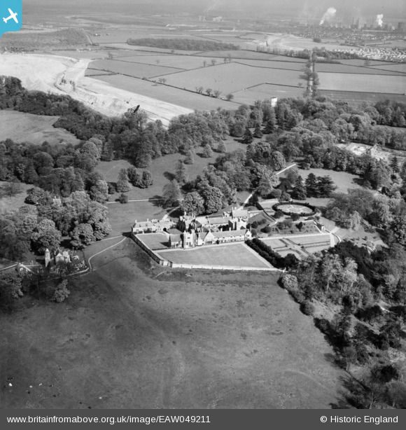
EAW049211 ENGLAND (1953). Rockingham Castle, Rockingham, from the north-west, 1953
© Copyright OpenStreetMap contributors and licensed by the OpenStreetMap Foundation. 2025. Cartography is licensed as CC BY-SA.
Nearby Images (11)
EAW049211

EAW004979

EAW004978

EAW004977

EAW004976

EAW049212

EAW049209

EAW004975

EAW004980

EAW049210

EAW045480

Details
| Title | [EAW049211] Rockingham Castle, Rockingham, from the north-west, 1953 |
| Reference | EAW049211 |
| Date | 11-May-1953 |
| Link | |
| Place name | ROCKINGHAM |
| Parish | ROCKINGHAM |
| District | |
| Country | ENGLAND |
| Easting / Northing | 486560, 291367 |
| Longitude / Latitude | -0.72434156997216, 52.512943868382 |
| National Grid Reference | SP866914 |
Pins

MB |
Tuesday 27th of September 2016 10:01:36 PM |