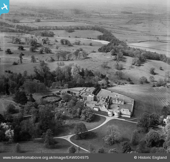
EAW004975 ENGLAND (1947). Rockingham Park and Castle, Rockingham, from the north-east, 1947
© Copyright OpenStreetMap contributors and licensed by the OpenStreetMap Foundation. 2025. Cartography is licensed as CC BY-SA.
Nearby Images (10)
Details
| Title | [EAW004975] Rockingham Park and Castle, Rockingham, from the north-east, 1947 |
| Reference | EAW004975 |
| Date | 7-May-1947 |
| Link | |
| Place name | ROCKINGHAM |
| Parish | ROCKINGHAM |
| District | |
| Country | ENGLAND |
| Easting / Northing | 486729, 291317 |
| Longitude / Latitude | -0.72186468541547, 52.512467564524 |
| National Grid Reference | SP867913 |
Pins

totoro |
Wednesday 16th of October 2013 04:29:09 PM | |

totoro |
Wednesday 16th of October 2013 04:24:44 PM | |

totoro |
Wednesday 16th of October 2013 04:13:12 PM | |

totoro |
Wednesday 16th of October 2013 04:09:27 PM | |

totoro |
Wednesday 16th of October 2013 04:09:03 PM | |

totoro |
Wednesday 16th of October 2013 04:08:41 PM | |

totoro |
Wednesday 16th of October 2013 04:08:27 PM | |

totoro |
Wednesday 16th of October 2013 04:08:11 PM | |

totoro |
Wednesday 16th of October 2013 04:07:49 PM | |

totoro |
Wednesday 16th of October 2013 04:06:24 PM |
User Comment Contributions
This view seems to be the basis for the plan in the visitors pamphlet, which has been referred to for the labels |

totoro |
Wednesday 16th of October 2013 04:07:13 PM |


![[EAW004975] Rockingham Park and Castle, Rockingham, from the north-east, 1947](http://britainfromabove.org.uk/sites/all/libraries/aerofilms-images/public/100x100/EAW/004/EAW004975.jpg)
![[EAW049209] Rockingham Castle and St Leonard's Church, Rockingham, 1953](http://britainfromabove.org.uk/sites/all/libraries/aerofilms-images/public/100x100/EAW/049/EAW049209.jpg)
![[EAW049212] Rockingham Castle and St Leonard's Church, Rockingham, 1953](http://britainfromabove.org.uk/sites/all/libraries/aerofilms-images/public/100x100/EAW/049/EAW049212.jpg)
![[EAW004977] Rockingham Castle, Rockingham, 1947. This image has been produced from a print.](http://britainfromabove.org.uk/sites/all/libraries/aerofilms-images/public/100x100/EAW/004/EAW004977.jpg)
![[EAW004976] Rockingham Castle, Rockingham, 1947. This image has been produced from a print.](http://britainfromabove.org.uk/sites/all/libraries/aerofilms-images/public/100x100/EAW/004/EAW004976.jpg)
![[EAW049210] Rockingham Castle, Rockingham, from the north-east, 1953](http://britainfromabove.org.uk/sites/all/libraries/aerofilms-images/public/100x100/EAW/049/EAW049210.jpg)
![[EAW004979] Rockingham Castle, Rockingham, 1947. This image has been produced from a print.](http://britainfromabove.org.uk/sites/all/libraries/aerofilms-images/public/100x100/EAW/004/EAW004979.jpg)
![[EAW004978] Rockingham Park and Castle, Rockingham, from the north, 1947. This image has been produced from a print.](http://britainfromabove.org.uk/sites/all/libraries/aerofilms-images/public/100x100/EAW/004/EAW004978.jpg)
![[EAW049211] Rockingham Castle, Rockingham, from the north-west, 1953](http://britainfromabove.org.uk/sites/all/libraries/aerofilms-images/public/100x100/EAW/049/EAW049211.jpg)
![[EAW004980] Rockingham Park and Castle, Rockingham, 1947](http://britainfromabove.org.uk/sites/all/libraries/aerofilms-images/public/100x100/EAW/004/EAW004980.jpg)