
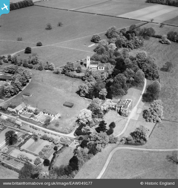
EAW049177 ENGLAND (1953). Loversall Hall and St Catherine's Church, Loversall, 1953
© Copyright OpenStreetMap contributors and licensed by the OpenStreetMap Foundation. 2026. Cartography is licensed as CC BY-SA.
Nearby Images (7)
EAW049177

EAW033456

EAW033459

EAW033457

EAW033458

EAW049175

EAW049176

Details
| Title | [EAW049177] Loversall Hall and St Catherine's Church, Loversall, 1953 |
| Reference | EAW049177 |
| Date | 11-May-1953 |
| Link | |
| Place name | LOVERSALL |
| Parish | LOVERSALL |
| District | |
| Country | ENGLAND |
| Easting / Northing | 457592, 398643 |
| Longitude / Latitude | -1.132060674015, 53.481101729375 |
| National Grid Reference | SK576986 |
Pins
Be the first to add a comment to this image!