
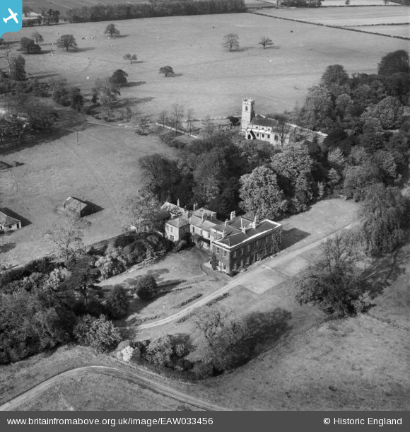
EAW033456 ENGLAND (1950). Loversall Hall and St Catherine's Church, Loversall, 1950
© Copyright OpenStreetMap contributors and licensed by the OpenStreetMap Foundation. 2025. Cartography is licensed as CC BY-SA.
Nearby Images (7)
EAW033456

EAW049177

EAW033459

EAW033457

EAW033458

EAW049175

EAW049176

Details
| Title | [EAW033456] Loversall Hall and St Catherine's Church, Loversall, 1950 |
| Reference | EAW033456 |
| Date | 12-October-1950 |
| Link | |
| Place name | LOVERSALL |
| Parish | LOVERSALL |
| District | |
| Country | ENGLAND |
| Easting / Northing | 457610, 398627 |
| Longitude / Latitude | -1.131792375774, 53.480955943912 |
| National Grid Reference | SK576986 |
Pins
Be the first to add a comment to this image!