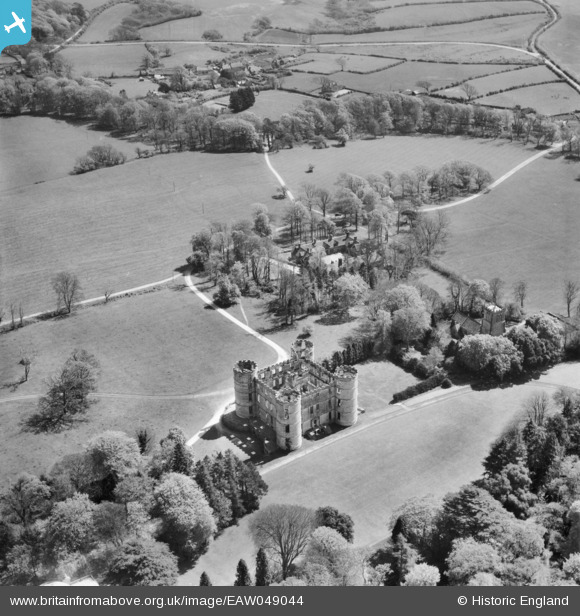
EAW049044 ENGLAND (1953). Lulworth Castle and St Andrew's Church, East Lulworth, 1953
© Copyright OpenStreetMap contributors and licensed by the OpenStreetMap Foundation. 2026. Cartography is licensed as CC BY-SA.
Details
| Title | [EAW049044] Lulworth Castle and St Andrew's Church, East Lulworth, 1953 |
| Reference | EAW049044 |
| Date | 4-May-1953 |
| Link | |
| Place name | EAST LULWORTH |
| Parish | EAST LULWORTH |
| District | |
| Country | ENGLAND |
| Easting / Northing | 385448, 82151 |
| Longitude / Latitude | -2.2058071600349, 50.638285915663 |
| National Grid Reference | SY854822 |
Pins
Be the first to add a comment to this image!


![[EAW049044] Lulworth Castle and St Andrew's Church, East Lulworth, 1953](http://britainfromabove.org.uk/sites/all/libraries/aerofilms-images/public/100x100/EAW/049/EAW049044.jpg)
![[EAW049043] Lulworth Castle, St Andrew's Church and Lulworth Park, East Lulworth, from the south-east, 1953](http://britainfromabove.org.uk/sites/all/libraries/aerofilms-images/public/100x100/EAW/049/EAW049043.jpg)
![[EAW049045] Lulworth Castle and St Andrew's Church, East Lulworth, 1953](http://britainfromabove.org.uk/sites/all/libraries/aerofilms-images/public/100x100/EAW/049/EAW049045.jpg)