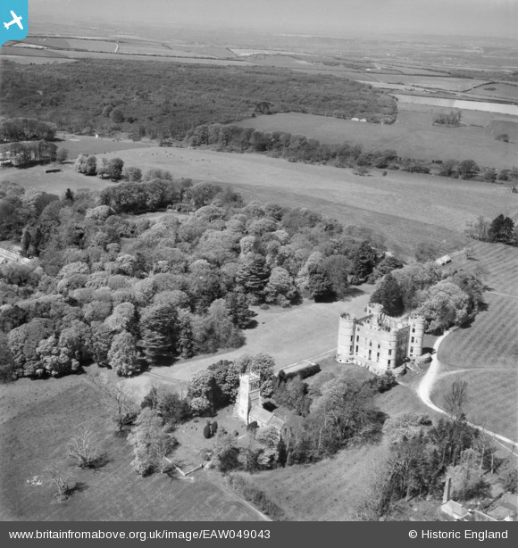
EAW049043 ENGLAND (1953). Lulworth Castle, St Andrew's Church and Lulworth Park, East Lulworth, from the south-east, 1953
© Copyright OpenStreetMap contributors and licensed by the OpenStreetMap Foundation. 2026. Cartography is licensed as CC BY-SA.
Details
| Title | [EAW049043] Lulworth Castle, St Andrew's Church and Lulworth Park, East Lulworth, from the south-east, 1953 |
| Reference | EAW049043 |
| Date | 4-May-1953 |
| Link | |
| Place name | EAST LULWORTH |
| Parish | EAST LULWORTH |
| District | |
| Country | ENGLAND |
| Easting / Northing | 385366, 82097 |
| Longitude / Latitude | -2.2069647350846, 50.63779819777 |
| National Grid Reference | SY854821 |
Pins

Bayman1 |
Wednesday 30th of March 2016 12:51:31 PM |


![[EAW049043] Lulworth Castle, St Andrew's Church and Lulworth Park, East Lulworth, from the south-east, 1953](http://britainfromabove.org.uk/sites/all/libraries/aerofilms-images/public/100x100/EAW/049/EAW049043.jpg)
![[EAW049045] Lulworth Castle and St Andrew's Church, East Lulworth, 1953](http://britainfromabove.org.uk/sites/all/libraries/aerofilms-images/public/100x100/EAW/049/EAW049045.jpg)
![[EAW049044] Lulworth Castle and St Andrew's Church, East Lulworth, 1953](http://britainfromabove.org.uk/sites/all/libraries/aerofilms-images/public/100x100/EAW/049/EAW049044.jpg)