
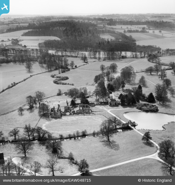
EAW048715 ENGLAND (1953). The ruins of Bayham Old Abbey, The Dower House and surrounding landscape, Little Bayham, from the north-east, 1953
© Copyright OpenStreetMap contributors and licensed by the OpenStreetMap Foundation. 2026. Cartography is licensed as CC BY-SA.
Nearby Images (7)
EAW048715

EAW048712

EAW024769

EAW024771

EAW048714

EAW048713

EAW043923

Details
| Title | [EAW048715] The ruins of Bayham Old Abbey, The Dower House and surrounding landscape, Little Bayham, from the north-east, 1953 |
| Reference | EAW048715 |
| Date | 8-April-1953 |
| Link | |
| Place name | LITTLE BAYHAM |
| Parish | FRANT |
| District | |
| Country | ENGLAND |
| Easting / Northing | 564999, 136562 |
| Longitude / Latitude | 0.35707253850905, 51.104049855463 |
| National Grid Reference | TQ650366 |
Pins
Be the first to add a comment to this image!