
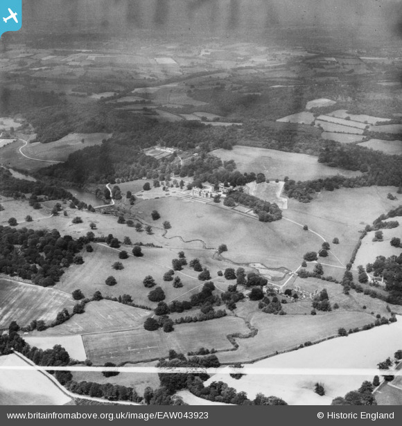
EAW043923 ENGLAND (1952). Bayham Abbey and the surrounding parkland, Little Bayham, from the south-east, 1952. This image was marked by Aerofilms Ltd for photo editing.
© Copyright OpenStreetMap contributors and licensed by the OpenStreetMap Foundation. 2026. Cartography is licensed as CC BY-SA.
Nearby Images (7)
EAW043923

EAW024771

EAW048714

EAW024769

EAW048712

EAW048715

EAW048713

Details
| Title | [EAW043923] Bayham Abbey and the surrounding parkland, Little Bayham, from the south-east, 1952. This image was marked by Aerofilms Ltd for photo editing. |
| Reference | EAW043923 |
| Date | 10-June-1952 |
| Link | |
| Place name | LITTLE BAYHAM |
| Parish | FRANT |
| District | |
| Country | ENGLAND |
| Easting / Northing | 564877, 136324 |
| Longitude / Latitude | 0.35522256690398, 51.10194640916 |
| National Grid Reference | TQ649363 |
Pins

J May |
Wednesday 12th of June 2024 03:41:02 PM | |
|
J May |
Wednesday 12th of June 2024 03:36:36 PM | |
|
J May |
Wednesday 12th of June 2024 03:36:19 PM | |
|
J May |
Wednesday 12th of June 2024 03:30:54 PM |