
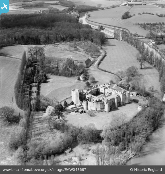
EAW048697 ENGLAND (1953). Allington Castle, Allington, 1953
© Copyright OpenStreetMap contributors and licensed by the OpenStreetMap Foundation. 2026. Cartography is licensed as CC BY-SA.
Nearby Images (19)
EAW048697

EPW009213

EPW026070

EAW023119

EAW023155

EPW005633

EAW048698

EAW048699

EPW005594

EPW009214

EAW048700

EAW005193

EAW023158

EAW002349

EAW023156

EAW023157

EAW002348

EAW023120

EAW002347

Details
| Title | [EAW048697] Allington Castle, Allington, 1953 |
| Reference | EAW048697 |
| Date | 8-April-1953 |
| Link | |
| Place name | ALLINGTON |
| Parish | |
| District | |
| Country | ENGLAND |
| Easting / Northing | 575135, 157920 |
| Longitude / Latitude | 0.51214604838103, 51.292930616267 |
| National Grid Reference | TQ751579 |
Pins

Matt Aldred edob.mattaldred.com |
Sunday 7th of March 2021 03:23:10 PM | |
|
Matt Aldred edob.mattaldred.com |
Sunday 7th of March 2021 03:23:01 PM | |

jrussill |
Friday 8th of April 2016 04:02:36 PM | |
|
jrussill |
Friday 8th of April 2016 04:02:15 PM | |
|
MB |
Sunday 22nd of June 2014 09:37:31 PM |
User Comment Contributions

2 x pillboxes in view |
jrussill |
Friday 8th of April 2016 04:05:41 PM |